Tajikistan: Towards the Panj River and the Wakhan Corridor
In July 2018, we completed a 4x4 expedition from Dushanbe to Almaty in Central Asia.
In this article, I describe the first part of the trip from Dushanbe to Langar. For a good part of the way, we followed the Afghan border.
Our three-week 4x4 trip from Dushanbe to Almaty
From our expedition from Dushanbe, the capital of Tajikistan, to Almaty in Kazakhstan, I have written three articles on our impressions of the trip, which I present to you in chronological order:
- Part 1: Towards the Panj River and the Wakhan Corridor in Tajikistan (Dushanbe to Langar) - You're there!
- Part 2: Crossing the Pamir Highlands in Tajikistan (Langar to Tulpar Kul)
- Part 3: Crossing the Tian San mountains in Kyrgyzstan (Tulpar Kul to Almaty)
Finally, the fourth article, which explains how we organized our trip to Tajikistan and Kyrgyzstan.
All texts in color coral indicate an internal or external link.
But where is Dushanbe?
I'm pretty sure that many of you wouldn't be able to locate Tajikistan, and even more so its capital, Dushanbe!
We're right in the heart of Central Asia, as you can see from the map below. The nearest seas are nearly two thousand kilometers away.
Tajikistan and Kyrgyzstan have mountain ranges with peaks of 6,000-7,000m. They lie on the Silk Roads between China and Turkey. They are former Soviet republics with a strong Muslim and Oriental culture.
Rather fascinating? Let's take a journey together to discover this little-known part of the world.

Dushanbe: the indolent one
We discover Dushanbe by plane. It's a lush city in the middle of an arid, ochre-colored landscape.
It's July, and we're hit by a scorching 38°C heat as soon as we leave the airport. Fortunately, the dry climate makes it bearable.
It's the trip's start, and we decide to wander the streets of Dushanbe without a specific sightseeing program.
What struck us is how quiet the city is: very few cars and very few people! Surprising for a capital city.
Why such a quiet capital?
Is it the heat? Possibly, but unlike most Middle Eastern countries, even in the evening the city is still asleep.
Is it the political climate? President Emomali Rahmon has been comfortably re-elected since 1994, and his son, Rustam Emomalii, mayor of the capital, is already in the running to take over from him. Needless to say, freedoms are tightly controlled in Tajikistan, and the cult of the leader's personality is clearly visible, with giant portraits all over the city.
Perhaps to compensate for this provincial feel, Emomali Rahmon saw fit to build an immense presidential palace that resembles the American White House, but much larger, and in front of which he erected the world's tallest flagpole, at 165 meters.
Is it poverty? Probably. Tajikistan is one of the poorest countries in the world, with a GDP per capita that ranks 160th, according to the IMF. We see very few restaurants and shops. With many Soviet-style residential buildings, we still imagine being in the USSR with its shortages.
A pleasant, shady town
However, thanks to its wide, shady avenues and parks, the city is far from unpleasant. We spend a pleasant time here.
We're staying at the Hotel Atlas. An accommodation with all the comforts we won't find again until the end of the trip in Almaty.


On the way to the Panj River and the Wakhan Corridor
We'll be traveling from Dushanbe to Almaty by 4x4.
Sherali, our guide, and Ismaïl, our driver, will accompany us all the way across Tajikistan to Tulpar Kul.
To keep track of us , I've made a map of our route.
This article covers the first part of our journey to Langar:
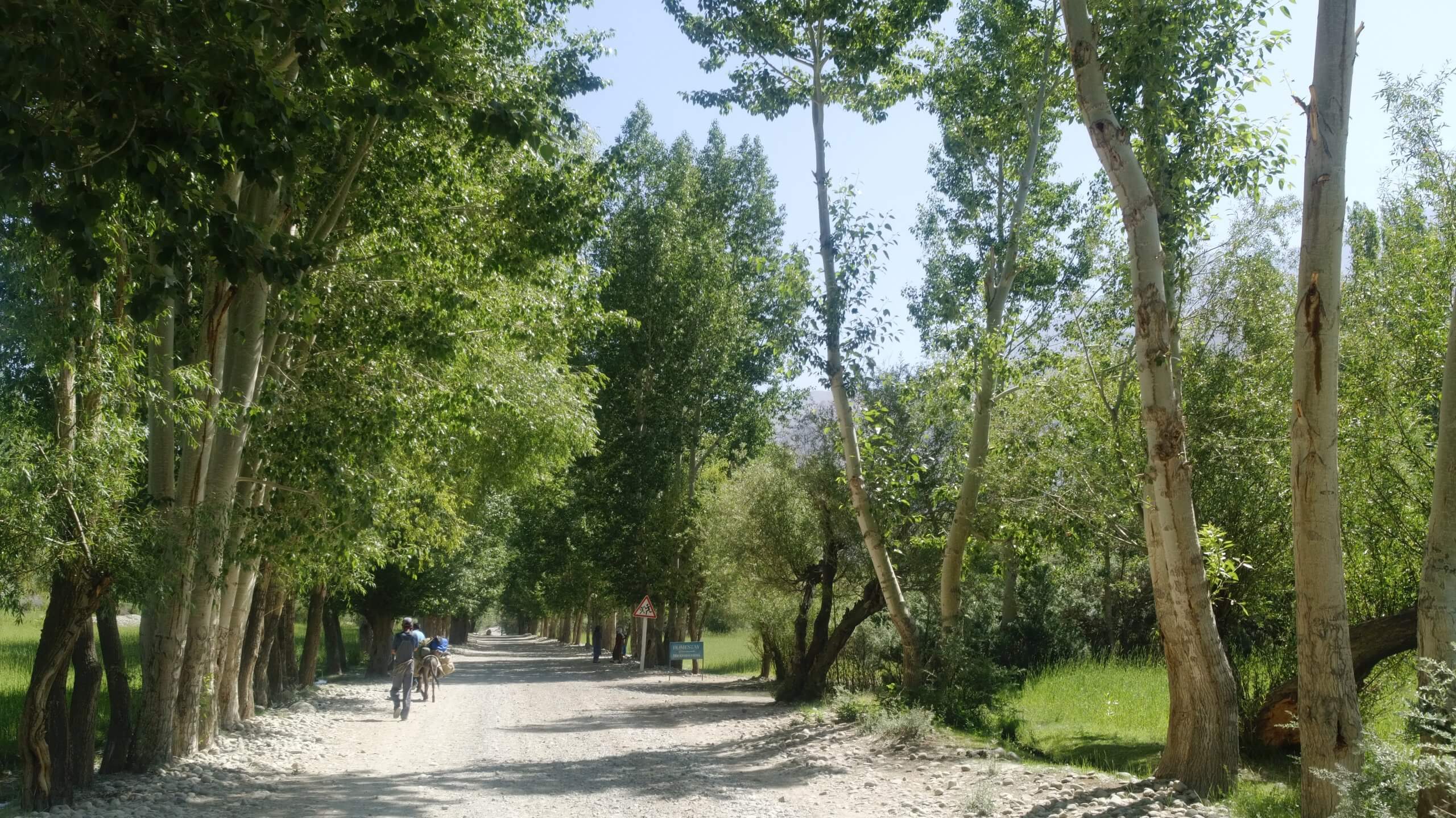
- From Dushanbe, we followed a long approach road, 365 km, to Kalaikum. After that, we are treated to nothing but exceptional scenery!
- From Kalaikum to Langar, we drive along the hypnotizing Panj River bordering Afghanistan. We passed through the town of Khorog, which is surprisingly dynamic in the middle of the Pamir mountains.
- We also did two great hikes to Geisev and at the foot of Pic Engels.
- We discovered the mysterious Wakhan corridor.

The road to Kalaikum is long and a little monotonous. Fortunately, two places of interest keep us waiting, like appetizers!

Our first stop is at the Nurek reservoir. However, we don't see the dam, which is the largest in Central Asia. The dam is vitally important economically, particularly for the energy required by the aluminum industry and for irrigating the agricultural land downstream.

Then we pass the Hulbuk fortress. This fortress played a major role around the 9th century, as it was located at a crossroads for trade. We then turn off towards the Afghan border, which we reach after climbing to the Shurabad pass.
The Panj River on the border with Afghanistan
From the Shurabad pass, we descend to the Panj river, which we follow for almost 700 km and is of great strategic importance as it marks the border with Afghanistan.
It will be our companion for several days and, depending on the topography of the place, will sometimes be languorous and spreading out in wide valleys or fiery in narrow canyons.
In fact, it's very hypnotic to follow the same river for so long.
In July, its water level is high, as numerous tributaries and streams join it, fed by melting snow and glaciers.


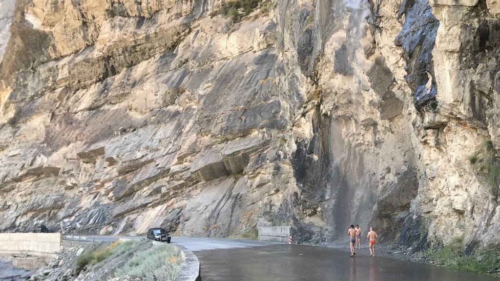
The road is generally not very good. Asphalt zones, sometimes in excellent condition but more often punctuated by innumerable potholes, alternate with dirt tracks. The 4x4 is very useful. We're driving on one of the country's most important roads, with trucks regularly arriving from China. Our average speed doesn't exceed 40 km/h.
We’re delighted to come across a refreshing waterfall and rush toward it, still accompanied by the relentless heat.
It's only in the early evening that we reach the village of Kalaikum , having covered just 380 km.
But that's just a stopover, because the next day we're back on the road to Geisev.
We're fascinated to see Afghanistan up close!
You have to realize that Afghanistan is just across the river. The border is in the middle of the river.
On the other side of the Panj River, we can often make out villages and Afghans moving about or doing their agricultural business.
It's quite fascinating to get such a close-up view of a country that has unfortunately been making the headlines for more than 20 years for its dramatic news. What we're seeing gives a much more peaceful picture of the country.
South of Khorog there's even a weekly market where Afghans and Tajiks meet.
In hindsight, Tajikistan's concern about having the Taliban as a neighbor is understandable. That's why you need a special permit to visit the Gorno-Badakshan Autonomous Oblast (GBAO).
Numerous checkpoints punctuate our journey. We notice that our driver regularly slips us a small bill to facilitate the checks.


Hiking to the Geisev valley: an oasis in the mountains
So it's with great pleasure that, in the early afternoon of this second day on the road, we abandon the 4x4 for our hiking shoes. The walk begins with an Indiana Jones-style bridge over the Bartang River, a tributary of the Panj.
We’re thrilled when the first snow-capped peaks come into view. We don't know it yet, but we'll see many more spectacular ones on our journey!
It's a pleasant warm-up. The valley climbs peacefully for 500 m in an arid landscape before we reach a hamlet amidst plantations of still-green wheat. Our host, Gulsha, welcomes us and seats us on a small shady veranda as it's tea time!
We're in one of the most isolated places on the planet, in a region of rugged, inhospitable mountains.
This small agricultural valley at 2500 m altitude feels like a small oasis! We wish we could have stayed longer.


En route to Khorog
The next day, we head back to the suspension bridge to meet our driver, Ismaïl. We have a long drive ahead of us. But to begin with, we're greeted by a festival in the village of Shadud, where the women dance merrily while the men crouch in disdain.
We learn that we are celebrating the 60th anniversary of the reign of the current Aga Khan, spiritual leader of the Ismailis, who is the reason for these dances.
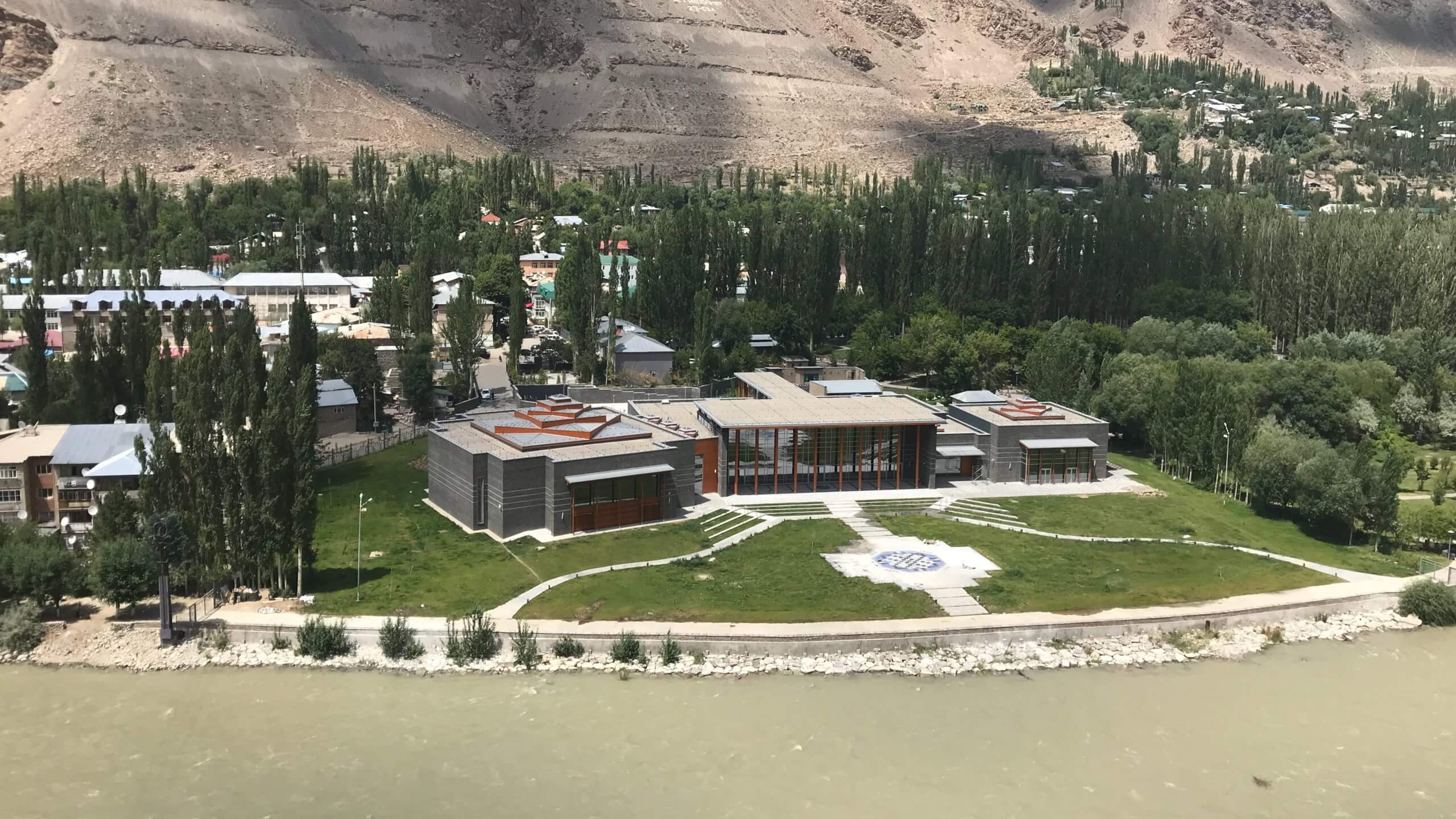
Khorog: a dynamic town in the middle of nowhere!
Khorog is a lively little town at 2200 m altitude, with a population of around 28,000. It seems quite ordinary to us, and it' s hard to imagine that we're 12 hours by car from the capital, and that Afghanistan is just across the road!
The Aga Khan has financed a brand-new Ismaili Center, which stands proudly amid the many poplar trees. The Ismaili faith is the majority here. It's a much gentler form of Islam than that practiced by the Taliban.
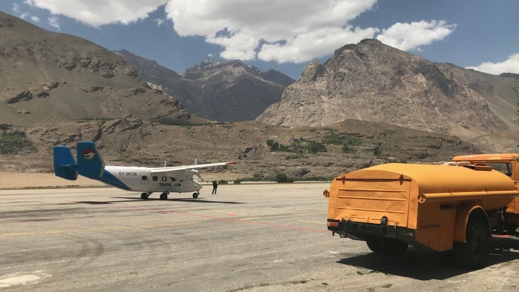
We arrive in Khorog via the airport just in time to see Tajik Air's Antonov An-28 take off for Dushanbe. I'd considered taking it. It would have saved us two days on the road, allowed us to discover the Pamir mountains at low altitude and have fun flying in a vintage, non-pressurized plane! If you want to see what it looks like, check out the video posted by Dan and Audrey or the one made by Zemia. Great, but scary too!
But the flight is often cancelled, so we preferred to avoid it.
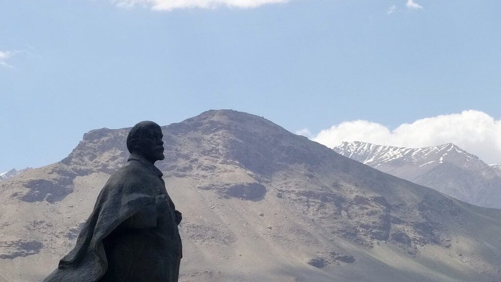
As we leave Khorog, we see a statue of Lenin, majestic in its mountain setting, to wish us a safe journey.
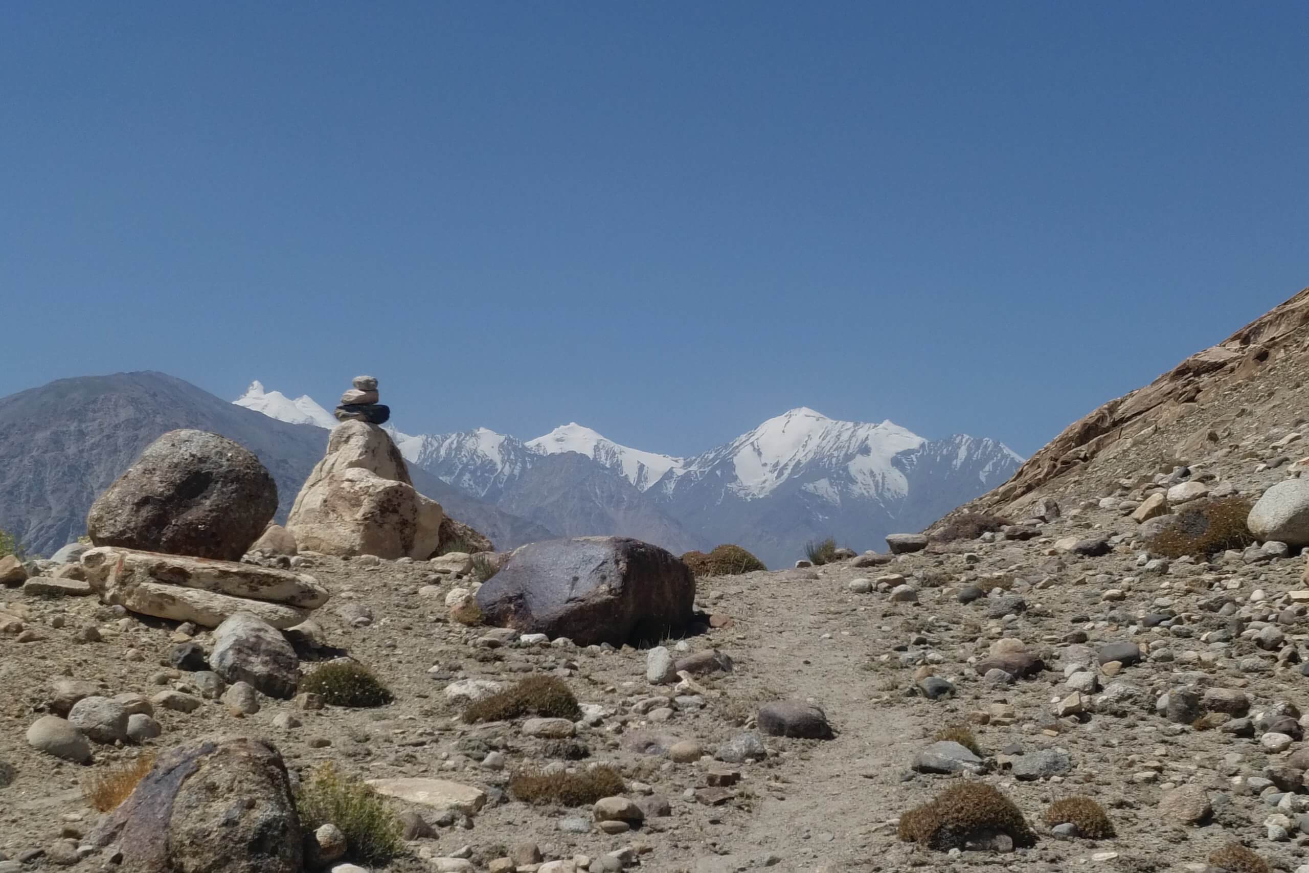
The mysterious Wakhan corridor
The scenery is as magnificent as ever. The lush green valley floor contrasts with the aridity of the mountains.
After around 100 km, we branch off, like the Panj River, into the famous Wakhan corridor, a historical landmark.
If you look at a map, you'll see an outgrowth of Afghanistan to the northeast. Its origins date back to the 19th century, when the British decided to entrust this territory to the Afghans to avoid a common border between the Russian Empire to the north and the British colonial empire to the south.
Since then, Pakistan has become independent, but the borders have remained unchanged.

The corridor is extraordinary.
Imagine a wide, virtually uninhabited river valley, framed by mountains 6,000 to 7,000 metres high.
It couldn't be more majestic! The photos only give a small impression of what we discover.
There are few places in the world where you can see so many different countries from the same spot: Tajikistan, Afghanistan, Pakistan and China!


12th-century Yamchun Fort
We had miscalculated our itinerary and regret not having scheduled an intermediate stopover before our planned overnight accommodation in Langar.
It took us almost 7 hours from our lunch in Khorog on a track that was not always in excellent condition. So, tired and frustrated, we arrive at our destination in the early evening.
We'll take the time to stroll around the ruins of the 12th-century Yamchun fort. The site is fabulous, as we're on the border with Afghanistan. Soldiers are on hand to guard the site.
However, we won't be visiting the Bibi Fatima hot springs, which we would have really appreciated after such a long drive!


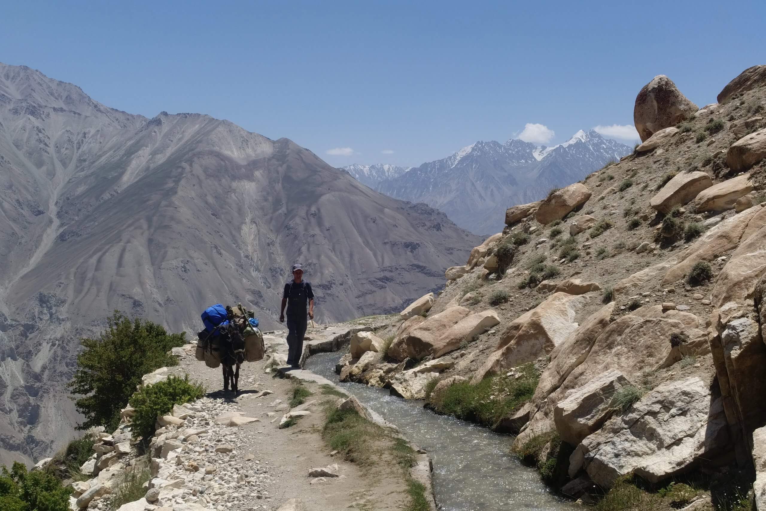
Hike to Engels Peak 6510 m
The following day, it's with great pleasure that we abandon the 4x4 for a real physical hike! Rest assured, we won't be going all the way to the top of Engels Peak at 6510 m, but we aim to reach a meadow at the foot of the peak, where the view is magnificent.
While the luggage is stowed on donkeys, Sherali briefs us for our two-day excursion to the first camp for climbers ascending Engels Peak: "We will start with a short warm-up in the valley, then we will have a slightly steep climb, but the rest of the ride is cool".
He just forgets to tell us that the "slightly steep" ascent involves a 1,200-metre drop that will take us to an altitude of almost 4,000 metres and a trail that rises almost vertically!

Looking back, we admire the mountains of Pakistan. We then walk along a canalized stream with our trusty donkey carrying our luggage.
By the time we reach the plateau where we'll be camping, I'm starting to feel the altitude sickness, with headaches and nausea. I go to bed quickly while Jean-Philippe sets off to explore the area.
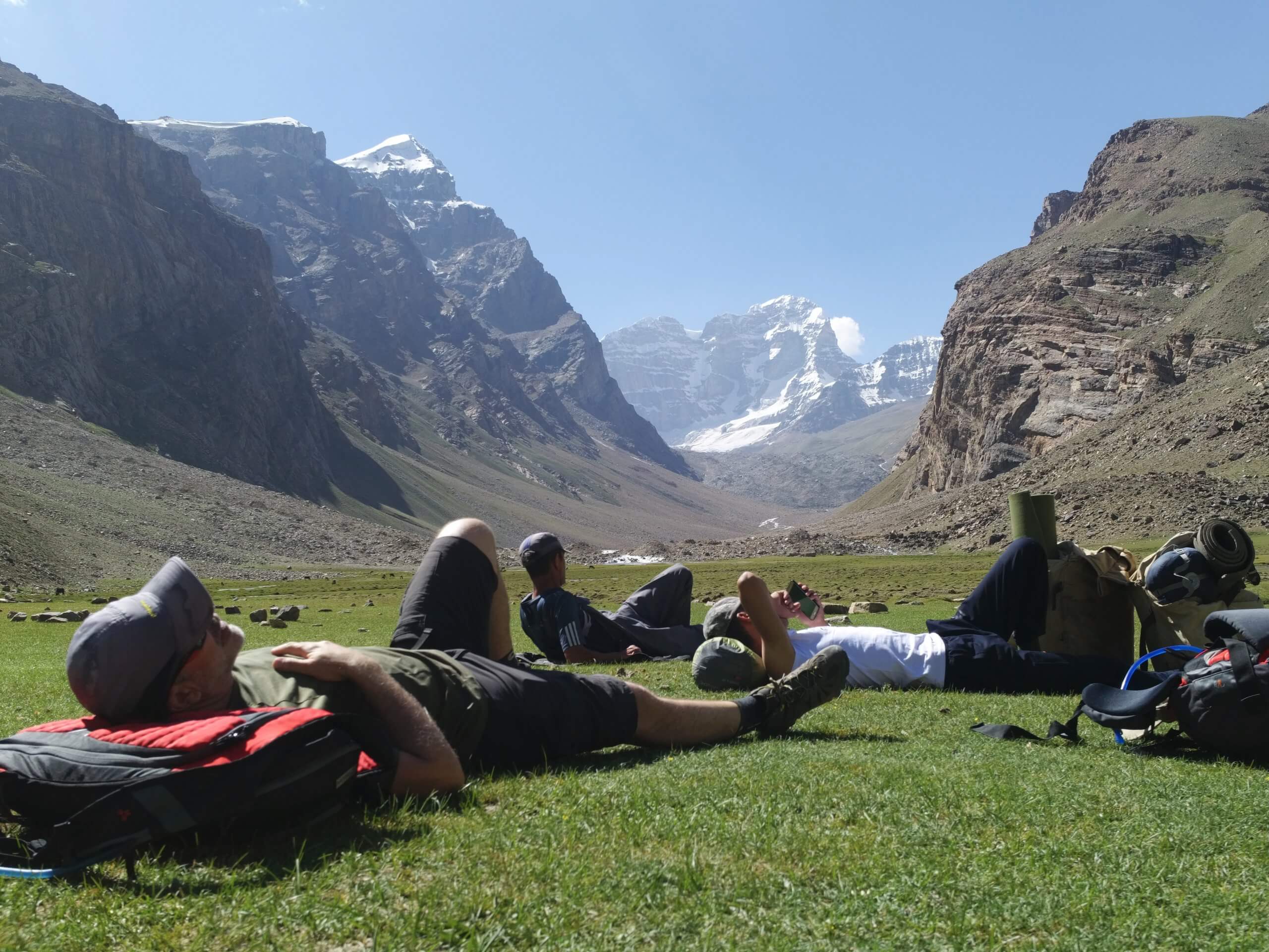
It's only after a good night's sleep that I can appreciate the grandiose setting, with Engels Peak in the background. We could have stayed another day to enjoy it even more.

Rock paintings
On the way down, Sherali takes a short detour to show us some rock engravings.
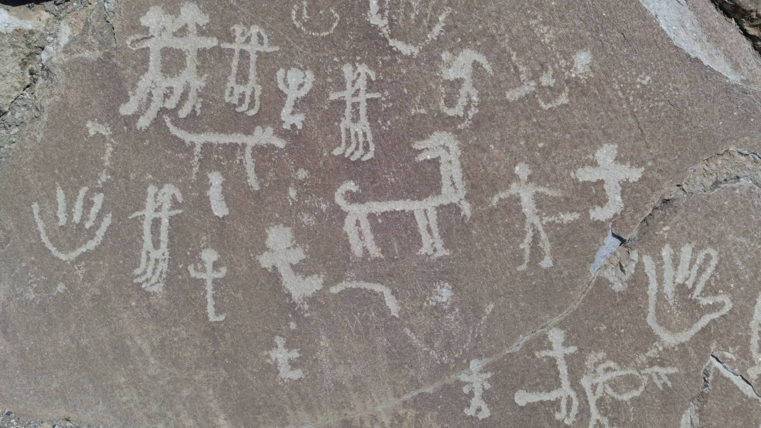
It's a moving experience to imagine these people in a mountain setting that has changed little since they first existed.
We're back in Langar by late morning.
We discuss with Sherali and Ismaïl to reorganize our tour to better balance the hours of driving and walking.
We prefer to see less, but avoid 10-hour stages like Geisev/Langar, which we found mind-numbing. We appreciate our travel companions' attentiveness and suggestions.
Discovering the Pamir highlands
We set off again for the Khargush pass at 4344 m. Read more about our adventures here
0 Comments