Tajikistan: Crossing the Pamir Highlands
In July 2018, we completed a 4x4 expedition from Dushanbe to Almaty in Central Asia.
In this article, I tell you about the second part of our trip which we spent on the high plateaus of the Pamir, rightly described as the roof of the world!
Our three-week 4x4 trip from Dushanbe to Almaty
From our expedition from Dushanbe, the capital of Tajikistan, to Almaty in Kazakhstan, I have written three articles on our impressions of the trip, which I present to you in chronological order:
- Part 1: Towards the Panj River and Wakhan Corridor in Tajikistan (Dushanbe to Langar)
- Part 2: Crossing the Pamir highlands in Tajikistan (Langar to Tulpar Kul) - You've made it!
- Part 3: Crossing the Tian San mountains in Kyrgyzstan (Tulpar Kul to Almaty)
Finally, the fourth article, which explains how we organized our trip to Tajikistan and Kyrgyzstan.
All texts in color coral indicate an internal or external link.
Discovering the Pamir highlands
To keep track of us , I've made a map of our route.
This article covers the second part of our expedition between Langar and Tulpar Kul.
- After our hike to Pic Engels we climbed up to the Pamir Highlands a truly unique experience!
- We hiked over a 5000 m pass to discover one of the most fabulous places on the planet: Lake Zorkul
- We continued on to the small town of Murghab with its western feel.
- Then we discovered Lake Karakul and its extraordinary colors
- Finally, we went to Kyrgyzstan to hike around the Lenin Peak.

Encounters on the way to Alichur
After descending from Engels Peak, mentioned in the previous article, and a hearty lunch, we set off in our 4x4 towards Alichur in the Pamir highlands. We climb to the Khargush pass at 4344 m.
Need I say that the scenery is superb?

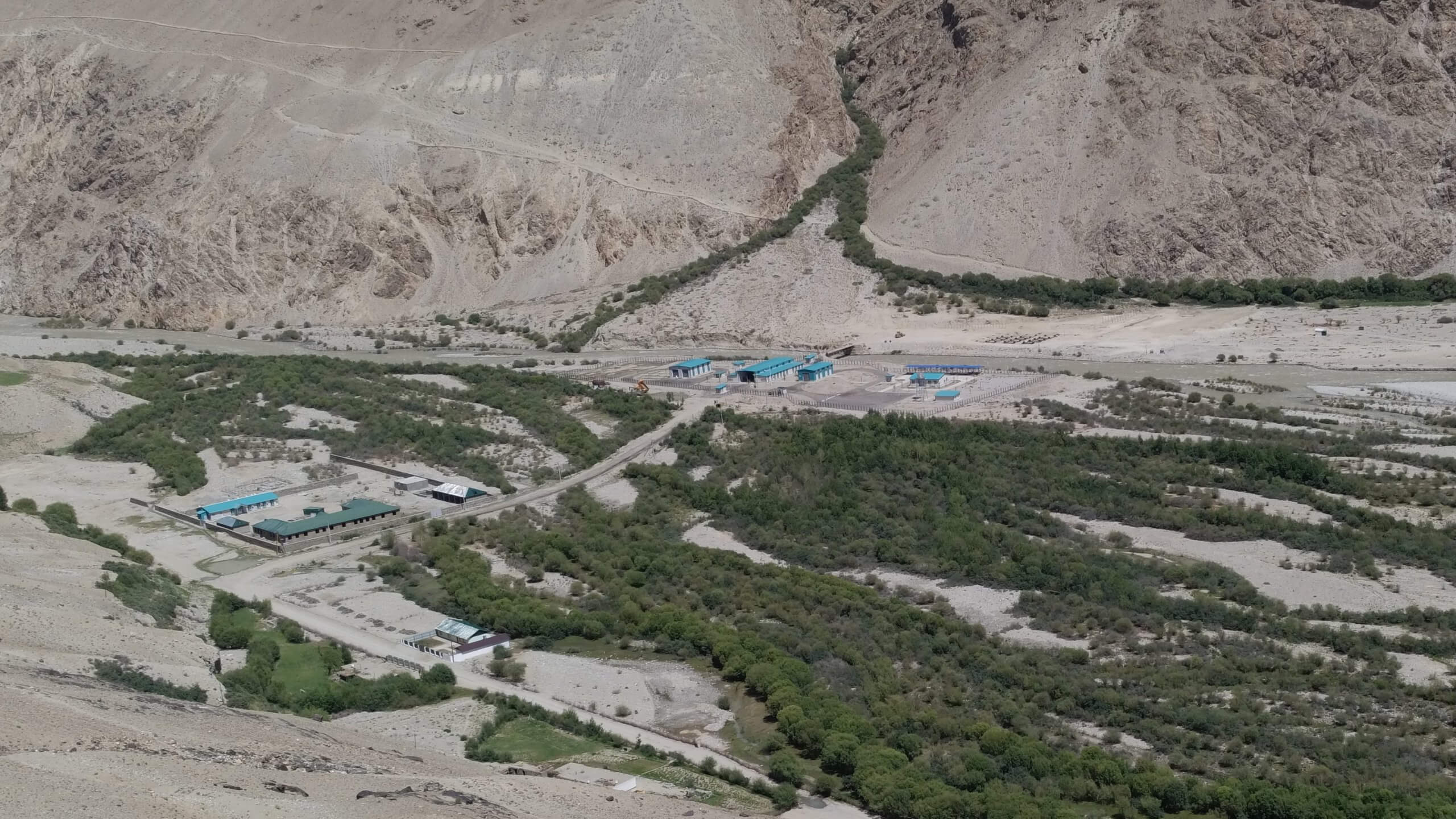
Sherali show us a camp built by the Chinese to facilitate imports into Tajikistan.
Travel is also about meeting other travelers.
Meeting with young English people
On the way up, we come across a group of young Englishmen with their car broken down in the middle of nowhere. We learn that they have come from Osh, in Kirghizstan, and have decided not to hire a driver. They've been stuck for several hours. Ismaïl tries to help them, but without success.
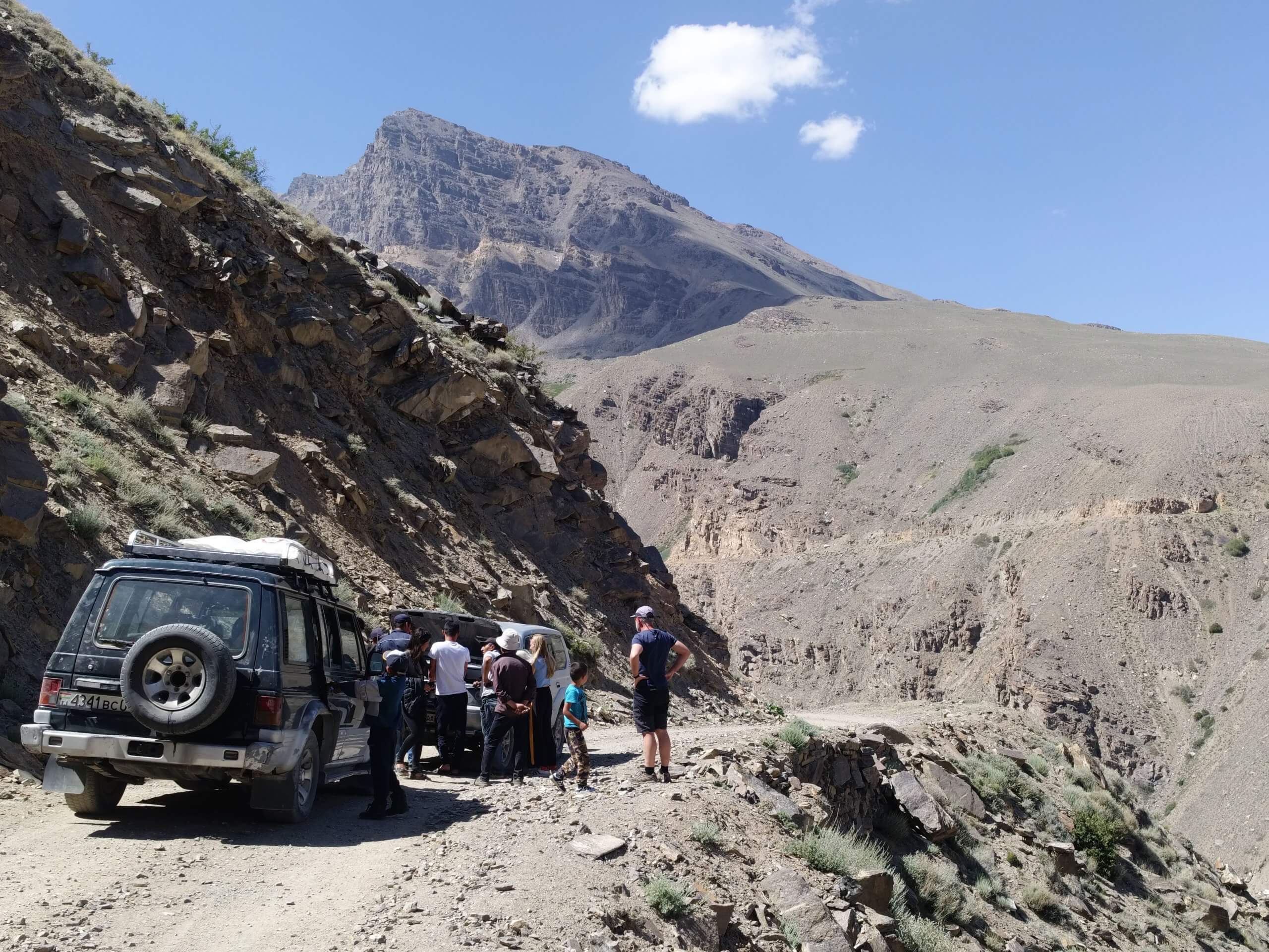
They will have to wait for a car to arrive in the same direction as them to try to find assistance in the next village. This tells us that too many reckless people want to travel the world as if they were in the Ardèche or Kent. Central Asia requires good preparation if you want to visit it safely.
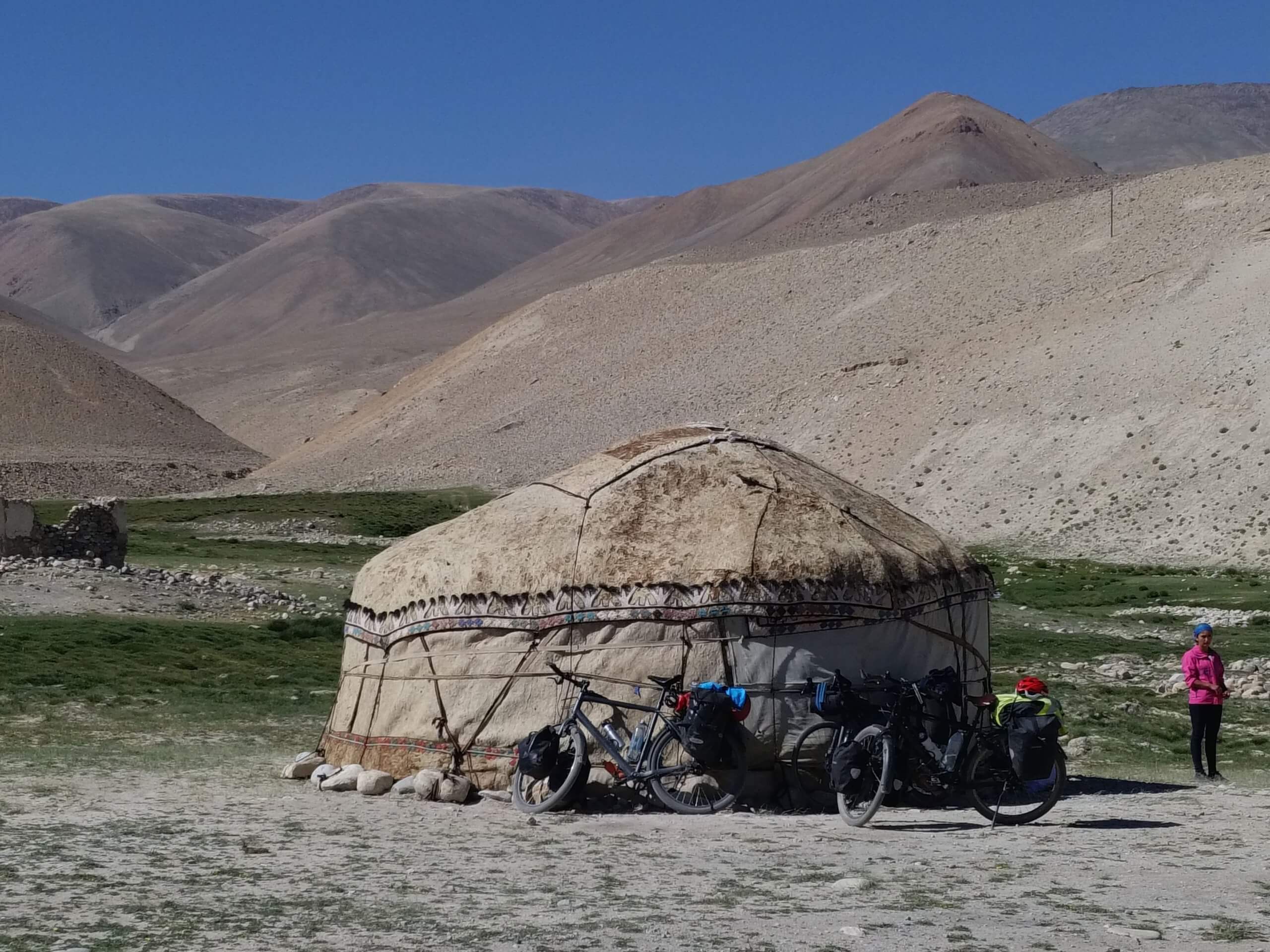
Meet a Dutch couple
Along the way, we meet many European cyclists. Most of them are young people who have taken up the sporting challenge of pedaling through these high, beautiful and isolated mountains.
Among them, we make an encounter we'll remember for the rest of our lives: A Dutch couple in their fifties who had left Thailand five months earlier to cycle to the Netherlands!
Living in Amsterdam at the time, we had a cordial exchange. Unlike the young Brits, these seasoned travelers are well prepared for their journey and impress us with their daring.
It was only on our return to the Netherlands that we learned from the press that they had been victims of a terrorist attack a few days later. He died and she was seriously injured.
It's all the more unfair because it's the only attack on tourists in this region for a long time.
In memory of René, you'll find below a photo of their bicycles sitting quietly beside the yurt where he was enjoying a cup of tea with his partner Kim, unaware of what awaited them.
Pamir plateau walks
We're now in the Pamir highlands, at around 4,000 metres. The desert landscapes are immense and we feel as if we've returned to the beginnings of mankind. The air is cool, and Dushanbe's heat has been long forgotten. The altitude gives us a slight euphoria that's not unpleasant.
Before reaching Alichur, we briefly detour to see the superb Lake Yashikul. This is one of the coldest places on the planet. In winter, temperatures can flirt with -60 degrees!
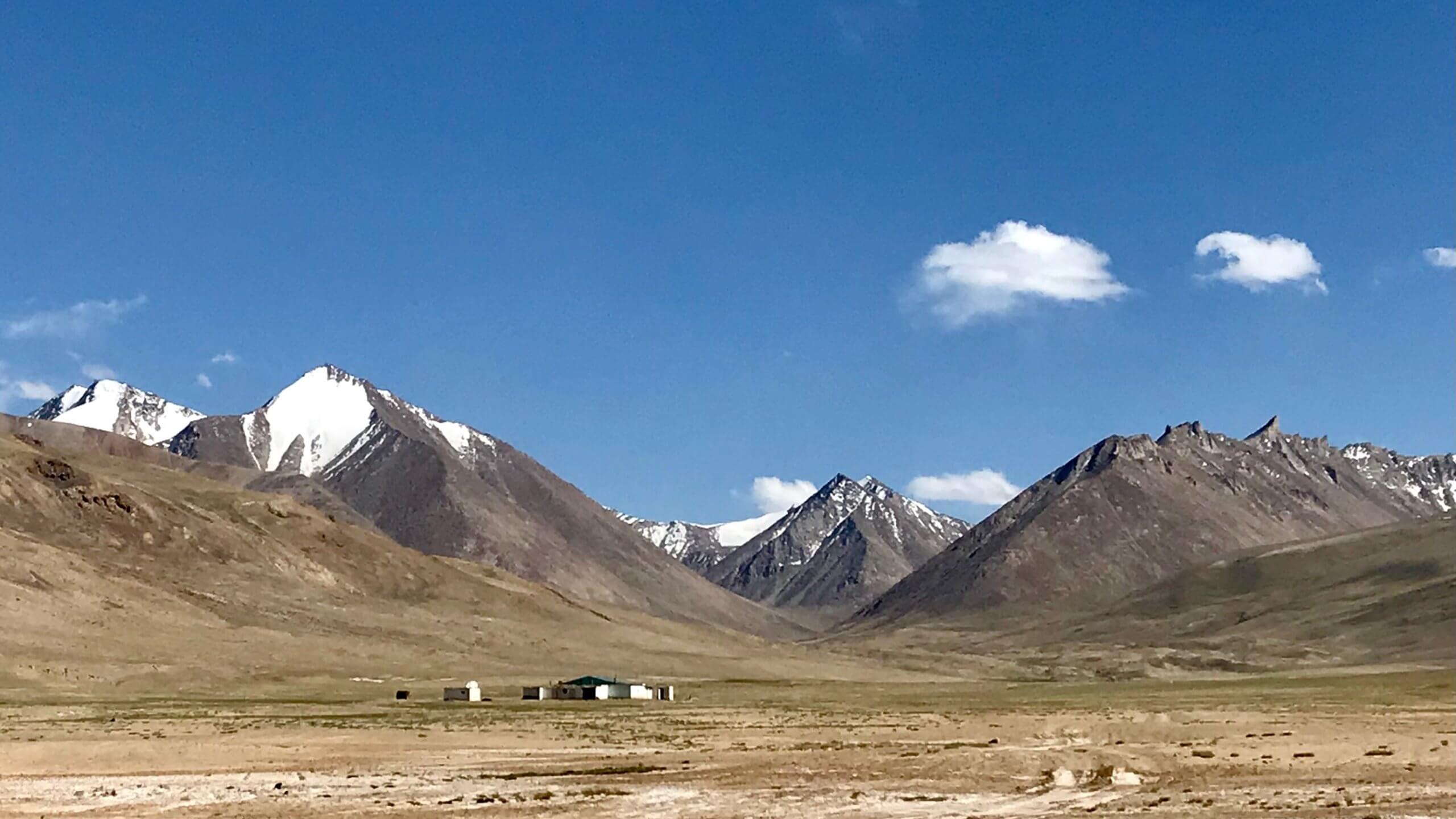
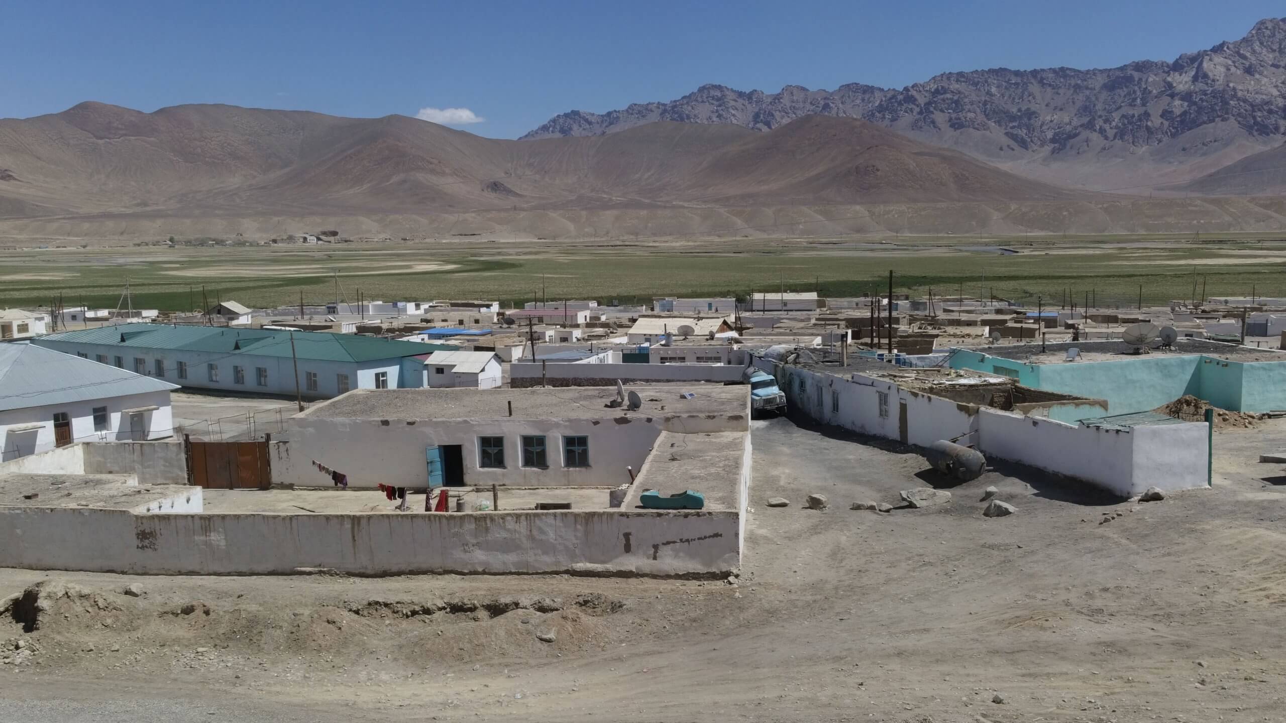
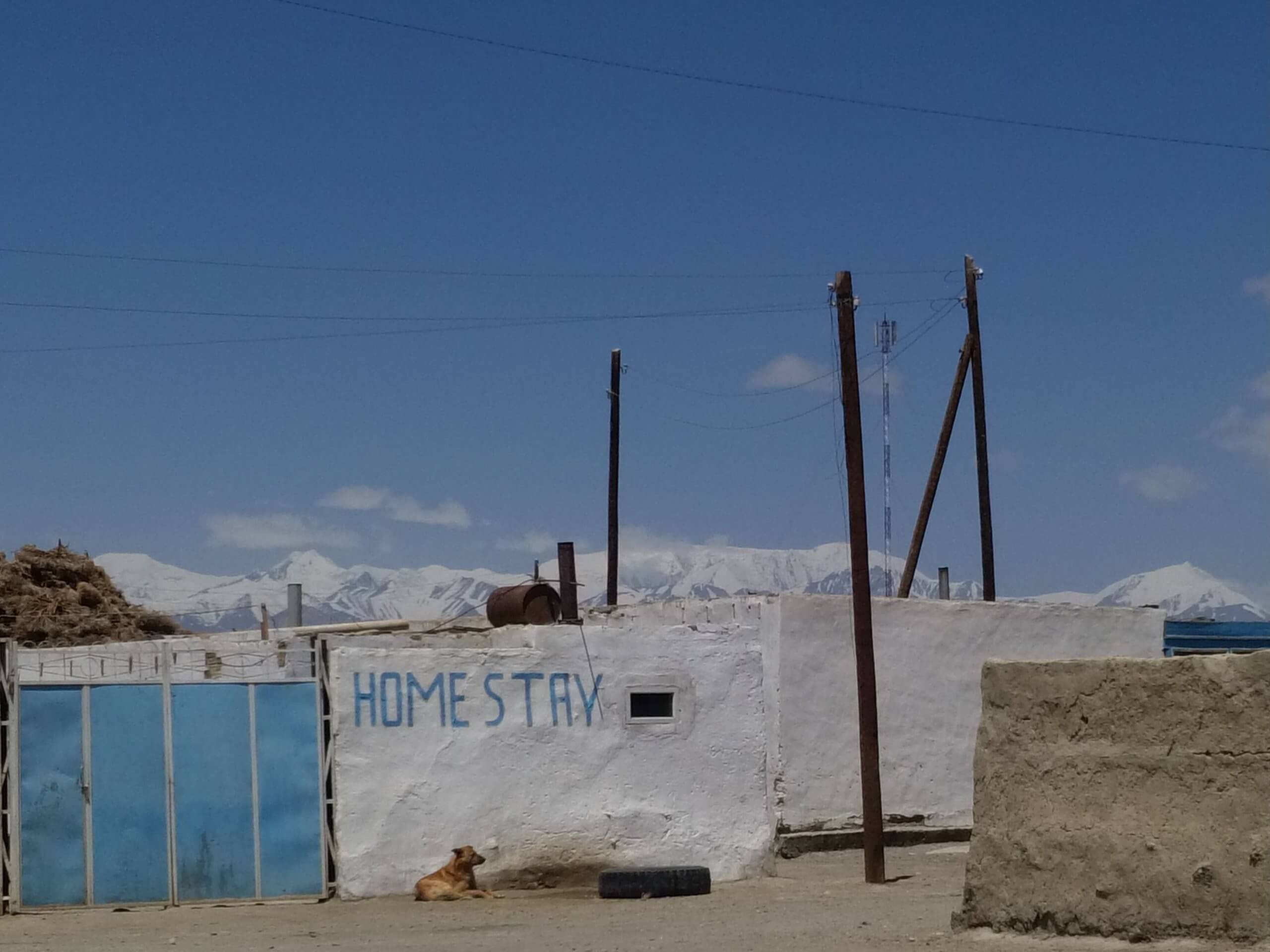
Alichur: the village of Sherali our guide
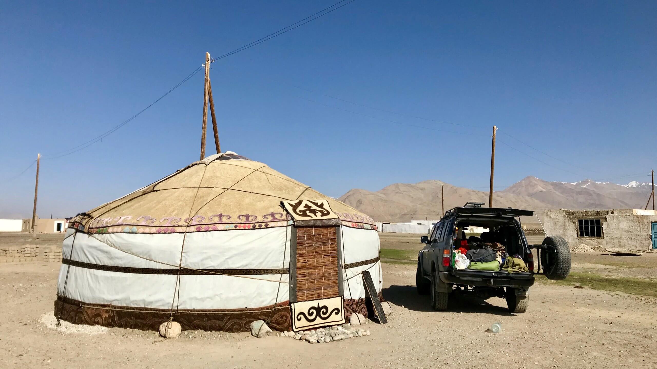
Alichur, population 1700, is Sherali's village. We stay in a spacious, comfortable yurt.
Then Sherali invites us to his home for tea and to meet his family.
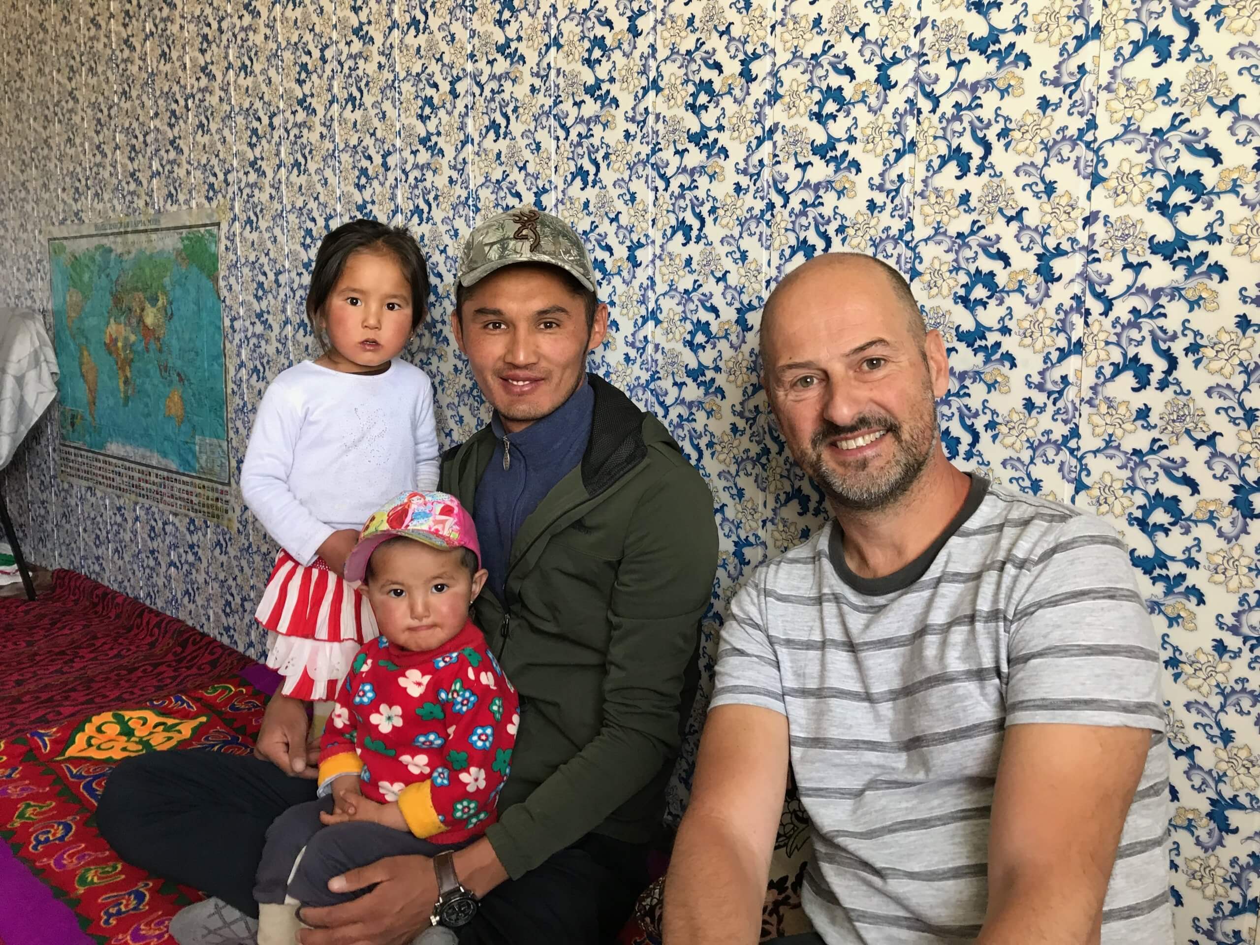
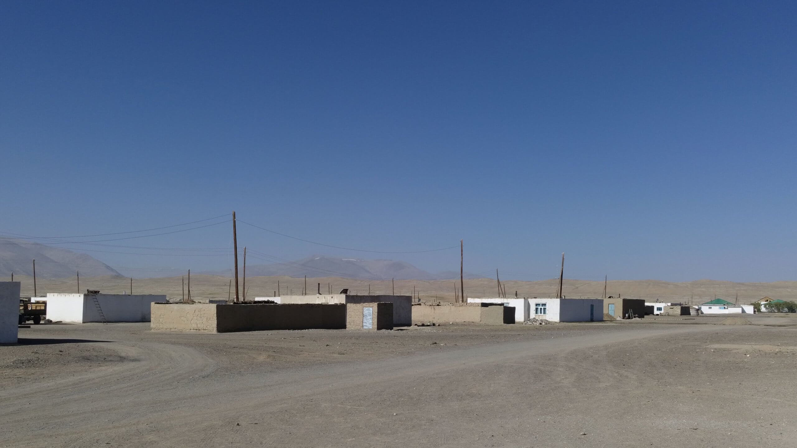
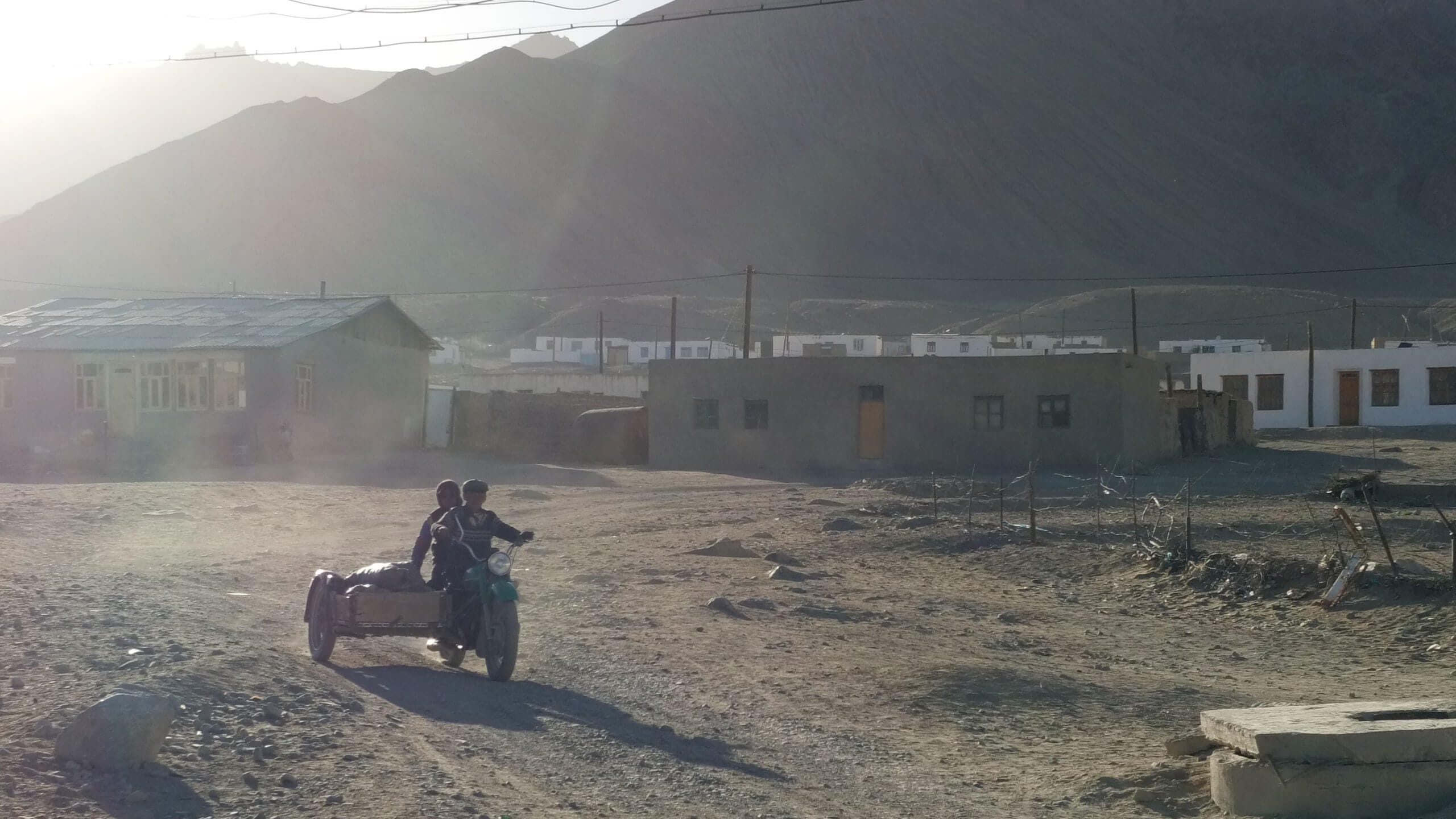
It's hard to imagine the life of our erudite, English-speaking guide in Alichur. It's the middle of summer and the village looks very austere. Imagine a few houses spaced far apart with no vegetation on a huge, windswept plateau.
And yet we're in the middle of summer. What must it be like in winter?
Another surprise: we see electric wires, but we're told that there's no electricity and that the inhabitants light themselves with candles or generators. Sherali explains that this network dates back to the USSR, and since independence many infrastructures have been abandoned for lack of means.
The Pamir plateaus
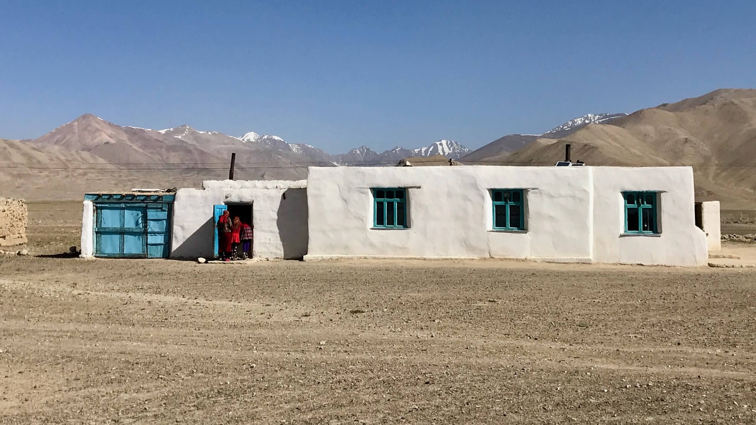
The next day, we continue over the plateau towards Keng Shiber. The scenery is all the same, yet nothing monotonous about it. From time to time, snow-capped peaks appear, making our eyes widen. There are also a few adobe buildings, which are probablyancient caravanserais.
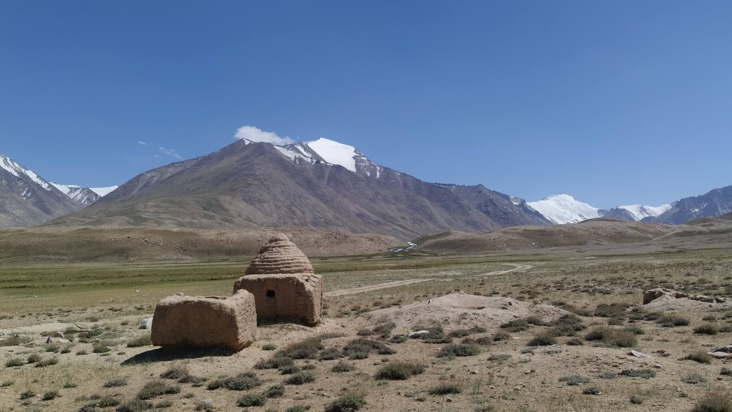
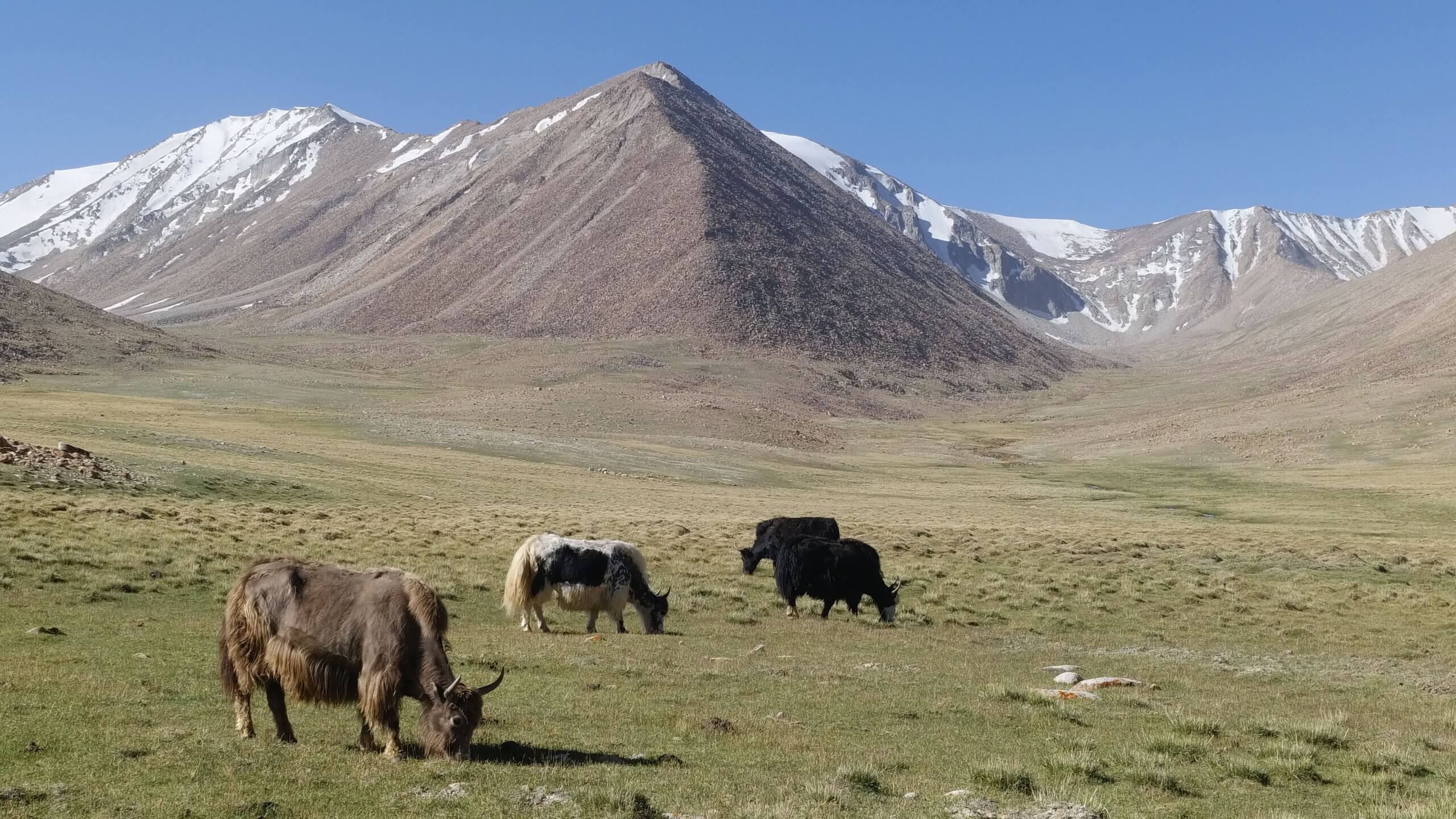
The road is short and we appreciate having the time to do some walking. This allows us to spot a richer fauna than we can see from the car. And still, high altitude lakes in landscapes that seem to stand still. Yaks graze peacefully. They're the only domestic animals we'll see.


Keng Shiber: A Hamlet in a movie Setting
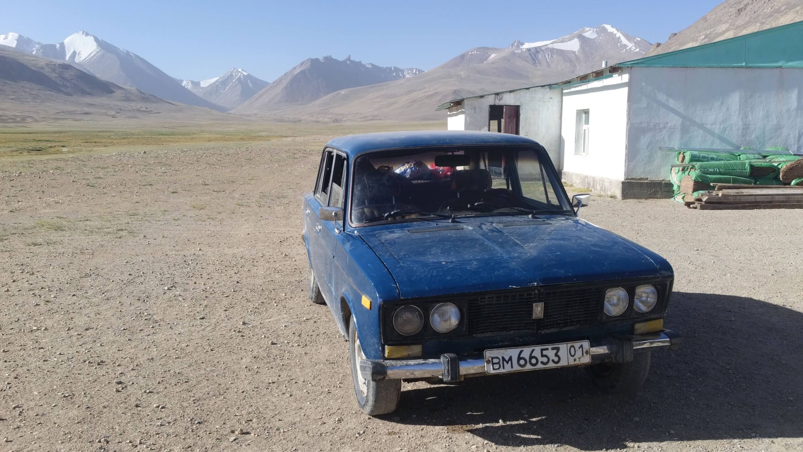
Keng Shiber is like a movie set. It's a tiny, slightly decrepit hamlet in majestic surroundings, where we'll spend the night before our most beautiful hike of the trip.
We see an old Lada, and wonder how it got there when we're already struggling with our 4x4.
Hike to Lake Zorkul, one of the most extraordinary places in the world!
The next day will be a great day. We will discover one of the most beautiful places on the planet! Nothing less!
We set off early in the morning for a long ascent on foot to a pass at over 5000 metres. At this altitude, progress is made step by step and breath is short, but Sherali promises us a pleasant surprise when we reach the other side.
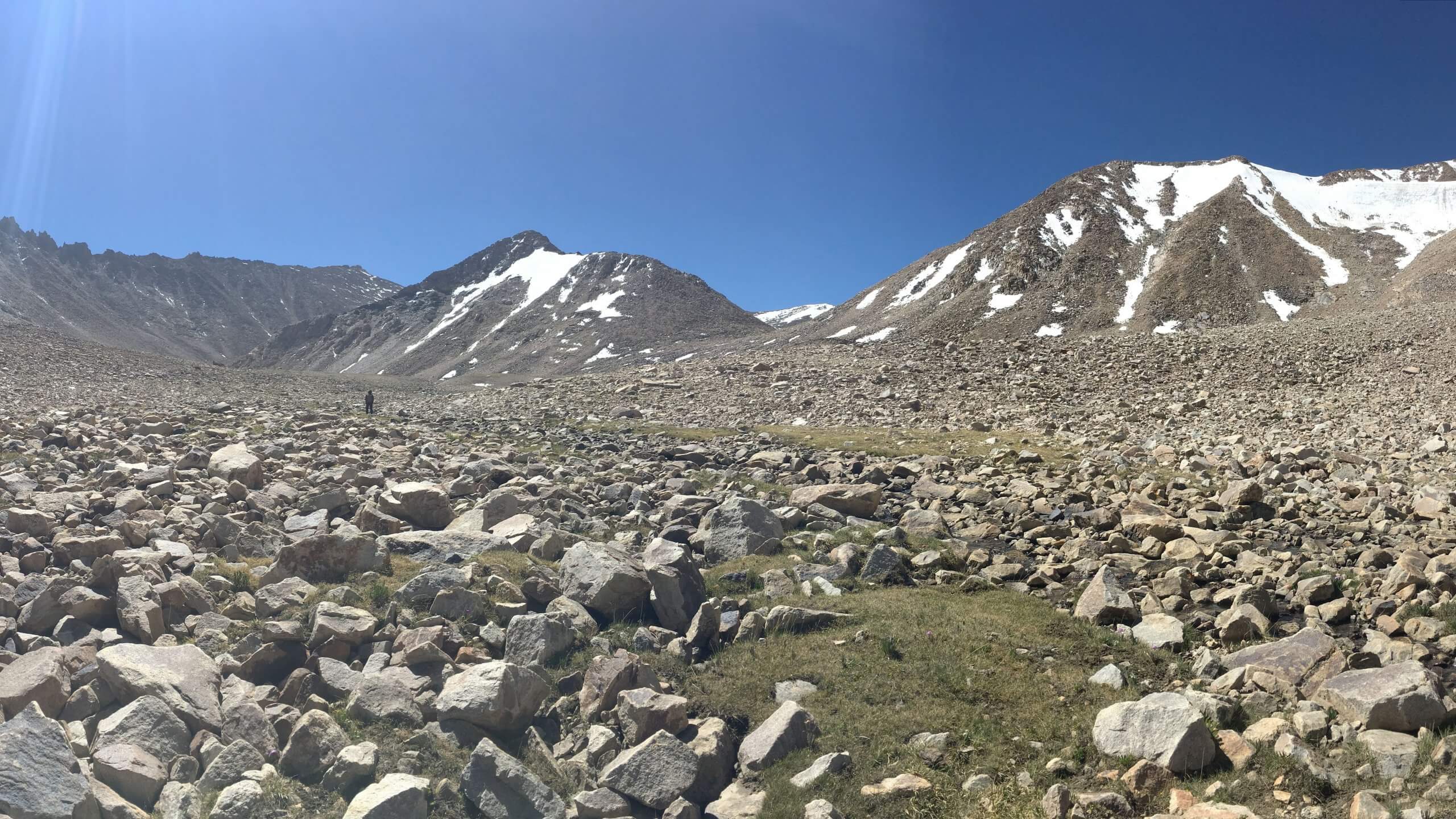
Indeed, when we arrived at the pass, it was a "Wahooh" effect like we've rarely experienced on a trip. In the background, we see an incredible range of snow-capped mountains in Afghanistan.
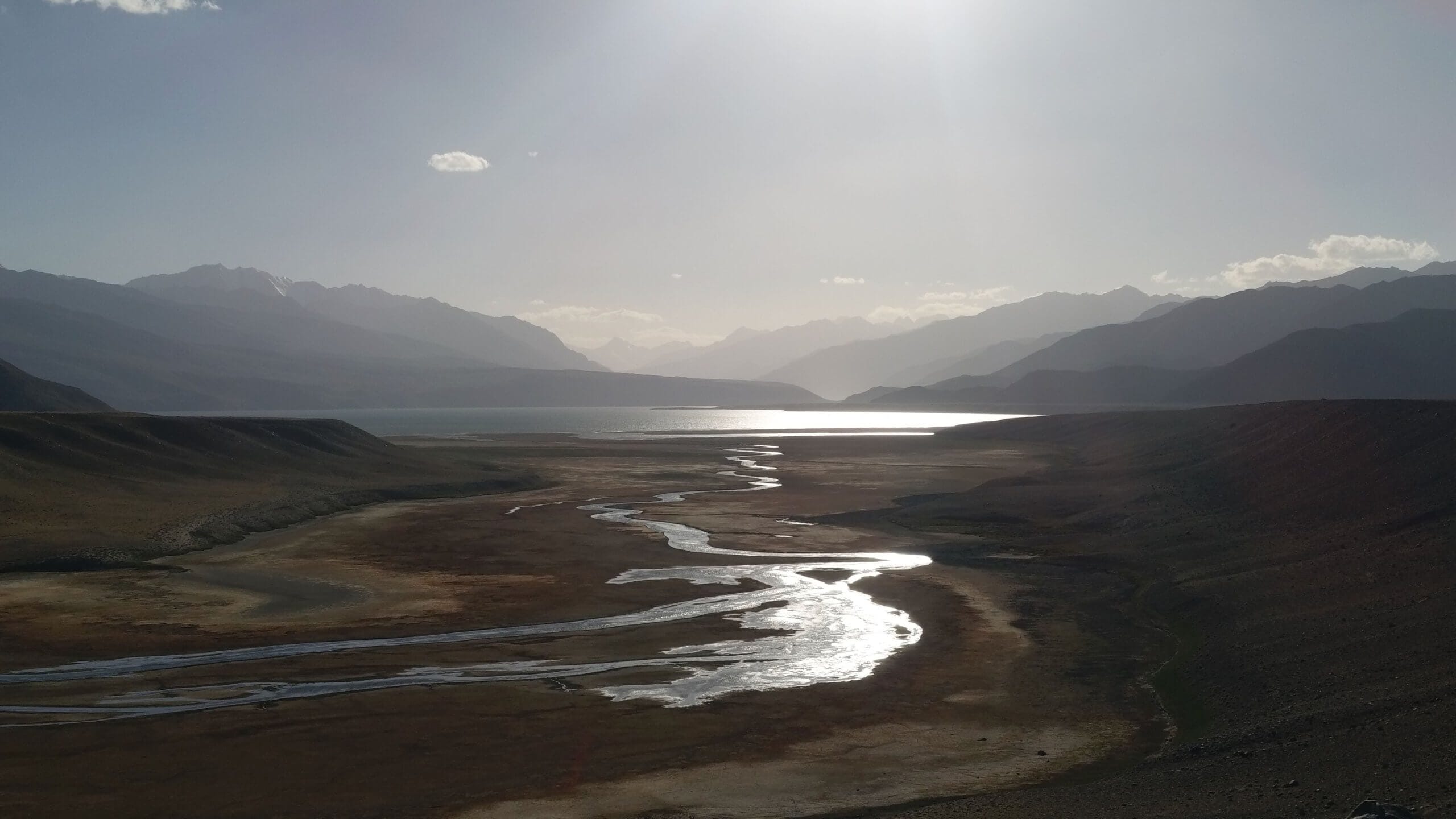
At their feet, we discover Lake Zorkul, straddling Tajikistan and Afghanistan. Pakistan and China are just behind!
The beauty of the site, untouched by human hands, is extraordinary. We hope its difficult access will preserve it for a long time.
The photos don't quite capture what we felt on site. We felt tiny in this immensity untouched by human presence.


Hot baths at Jarty Gumbez!
During our trek, Ismaïl took the 4x4 around the mountain. We meet up with him to go to Jarty Gumbez, where hot baths await us !

After a good night's sleep, we continue towards Murghab. But first we must cross a ford that impresses us more than our driver!
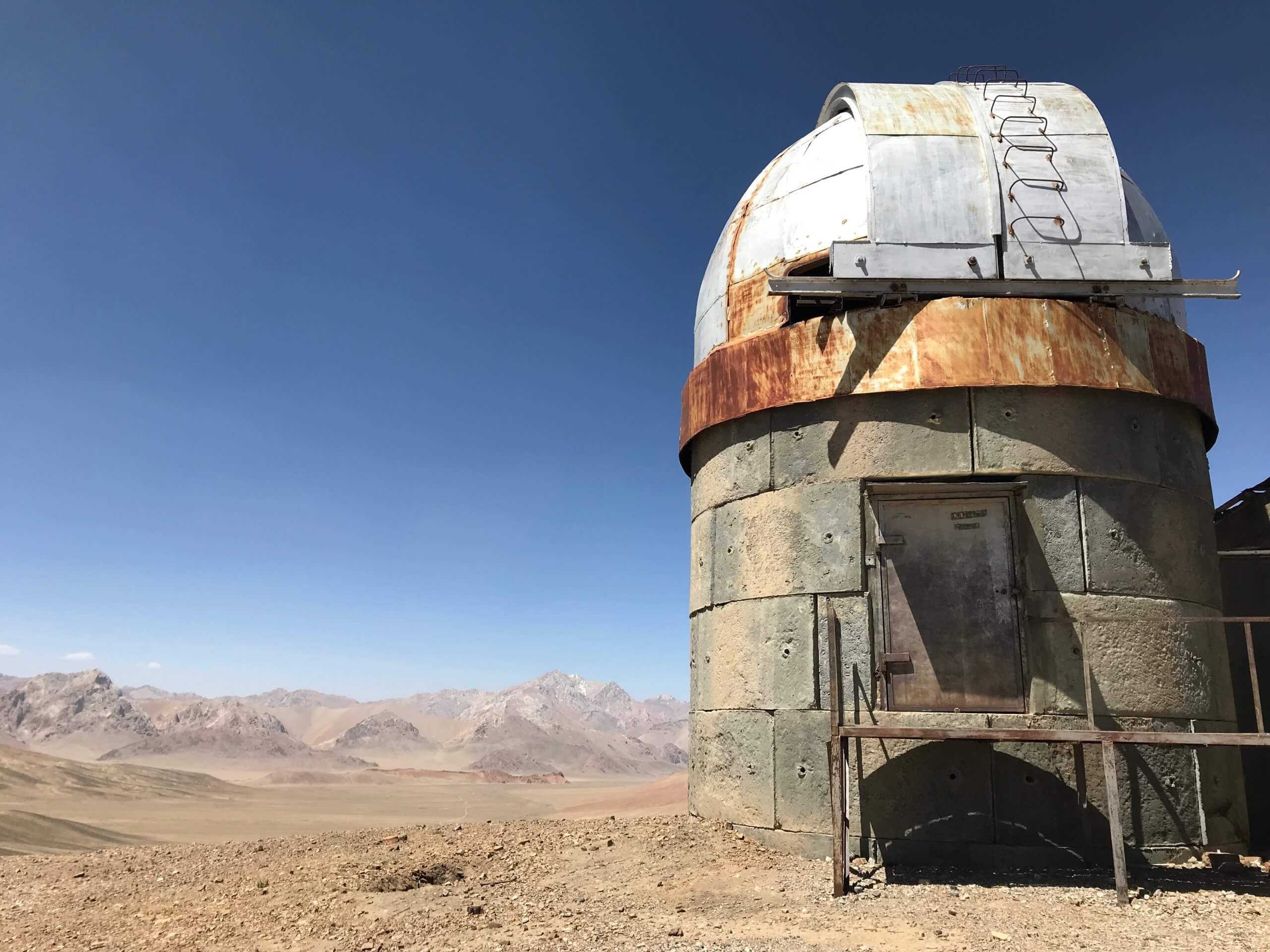
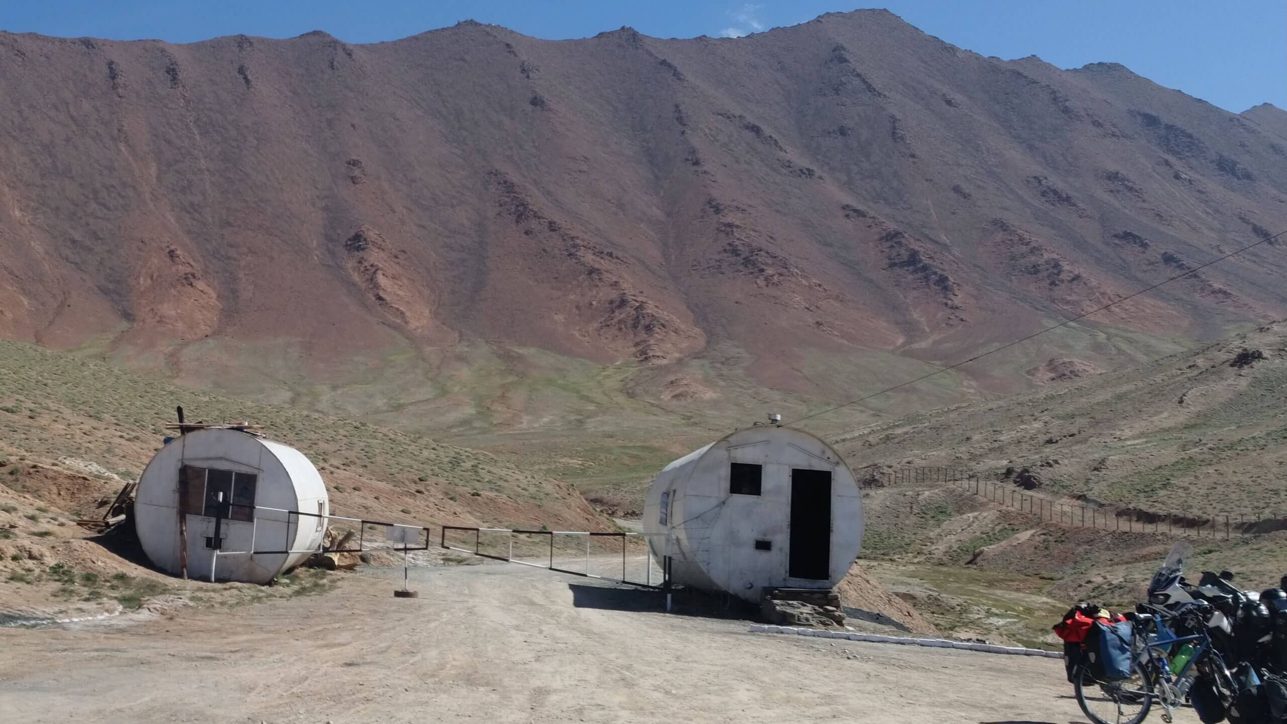
Shorbulak Observatory
Along the way, we'll see the Shakty rock paintings and the former Soviet observatory at Shorbulak. It has to be said that the sky is exceptionally pure, with no light pollution to explore the stars.
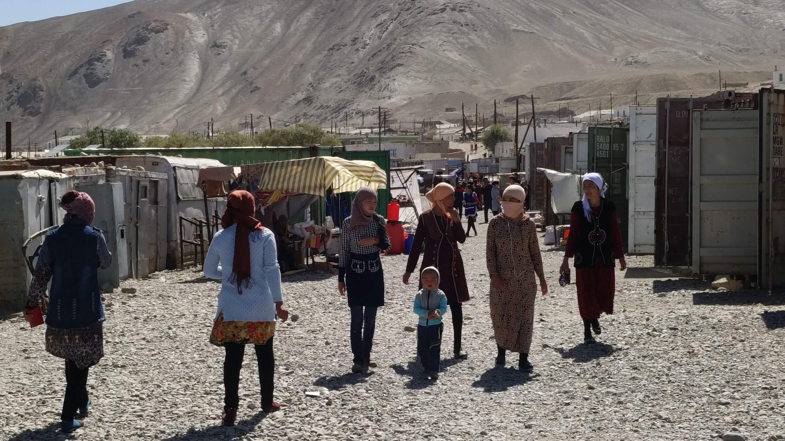
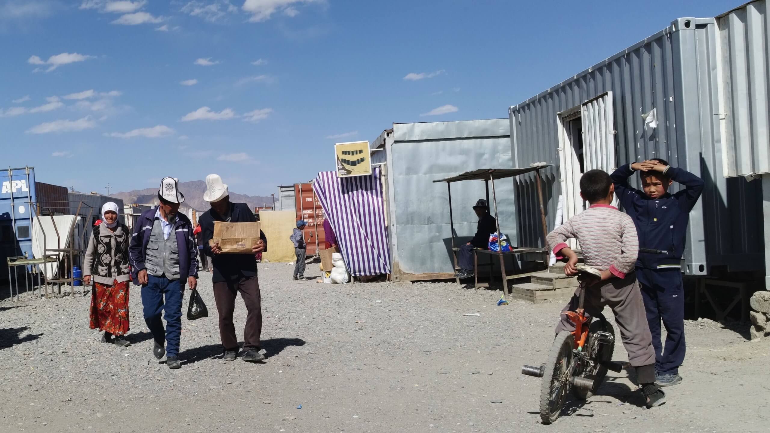
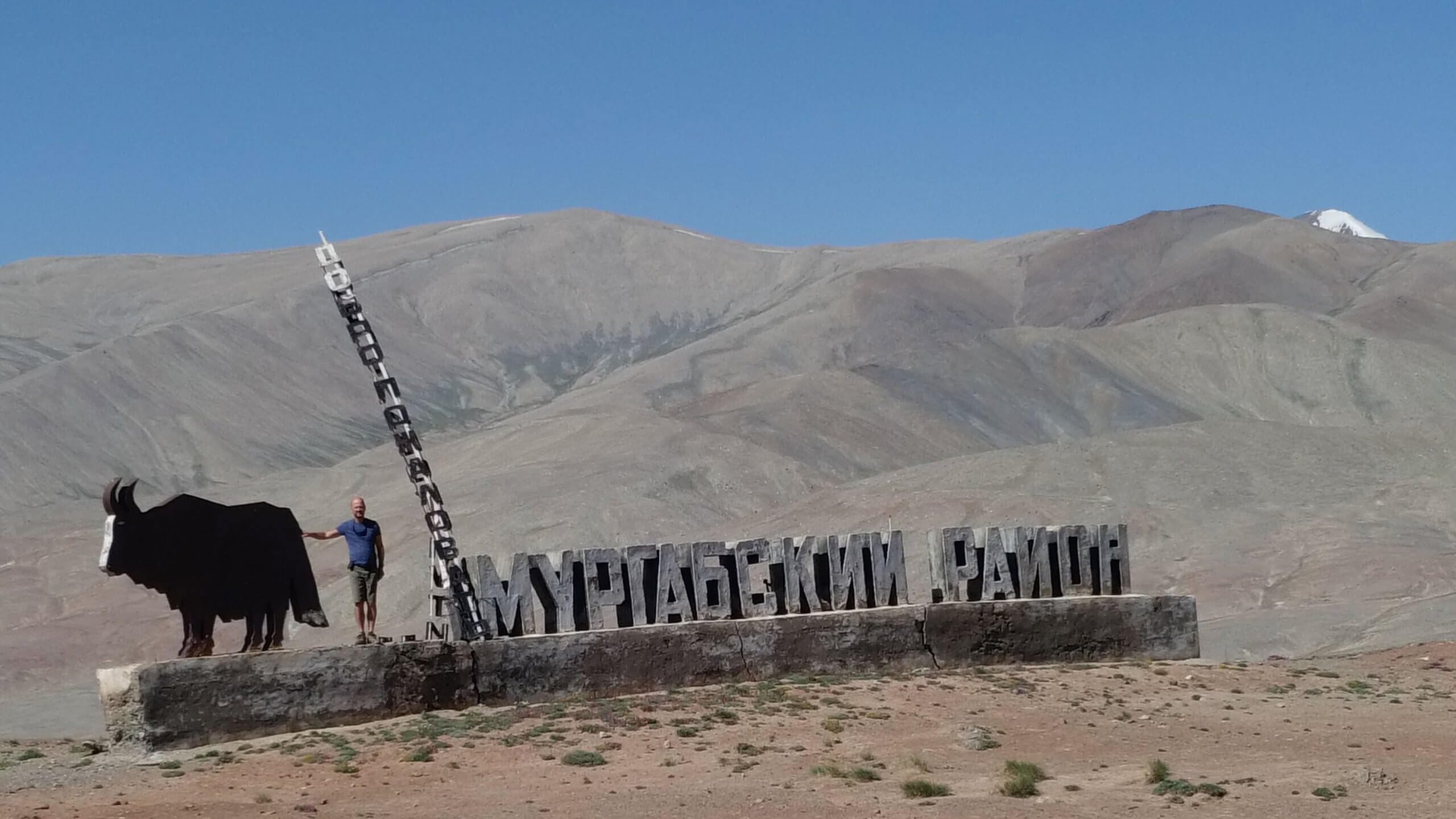
Murghab: the town at the end of the world
At 3600 meters and with a population of 4000 Murghab inhabitants, it is the only town of any importance in the eastern Pamir. This is where our driver lives and invites us to meet his family and have tea at his home.
If the end of the world exists, it's in Murghab!
Its market is surprisingly housed in shipping containers.
We see mostly idle men with beautiful Kyrgyz headdresses. The women are more discreet.

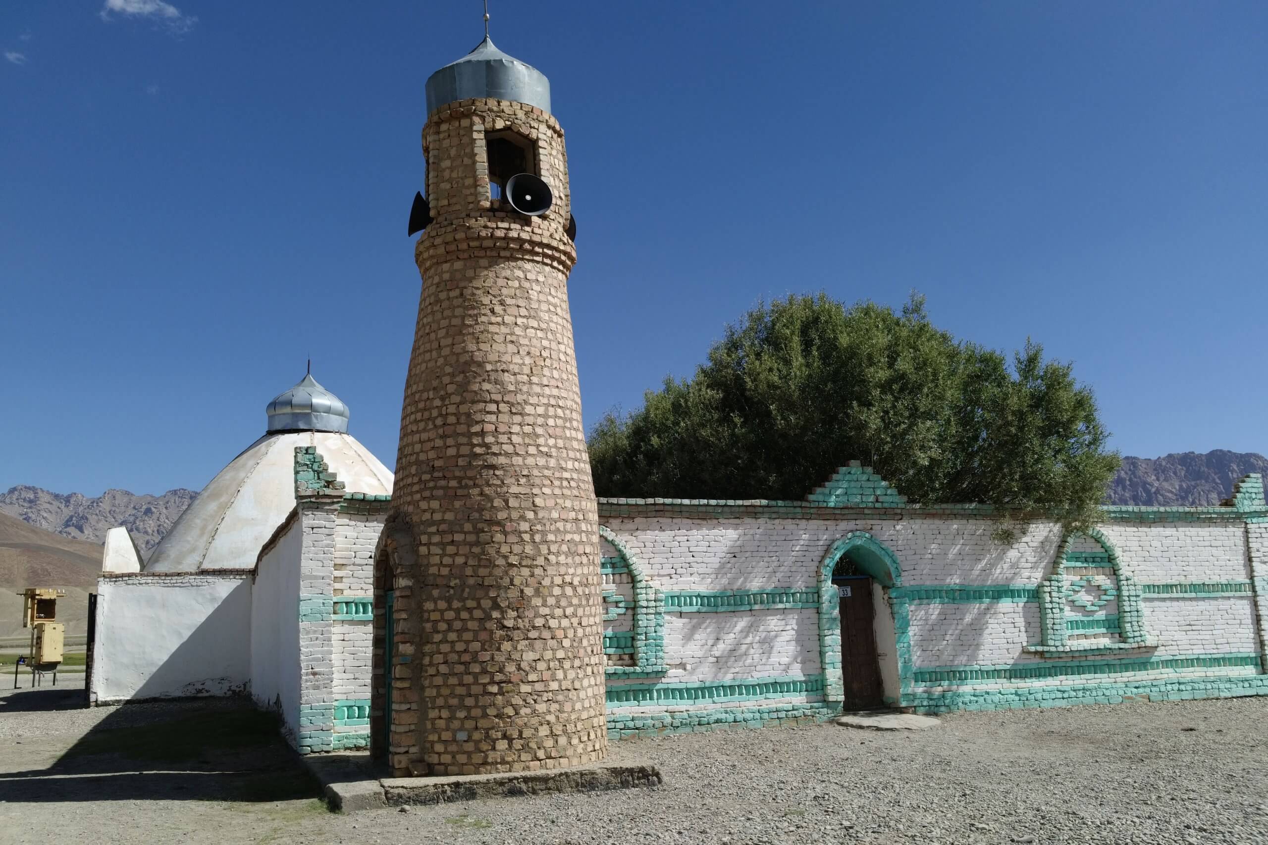
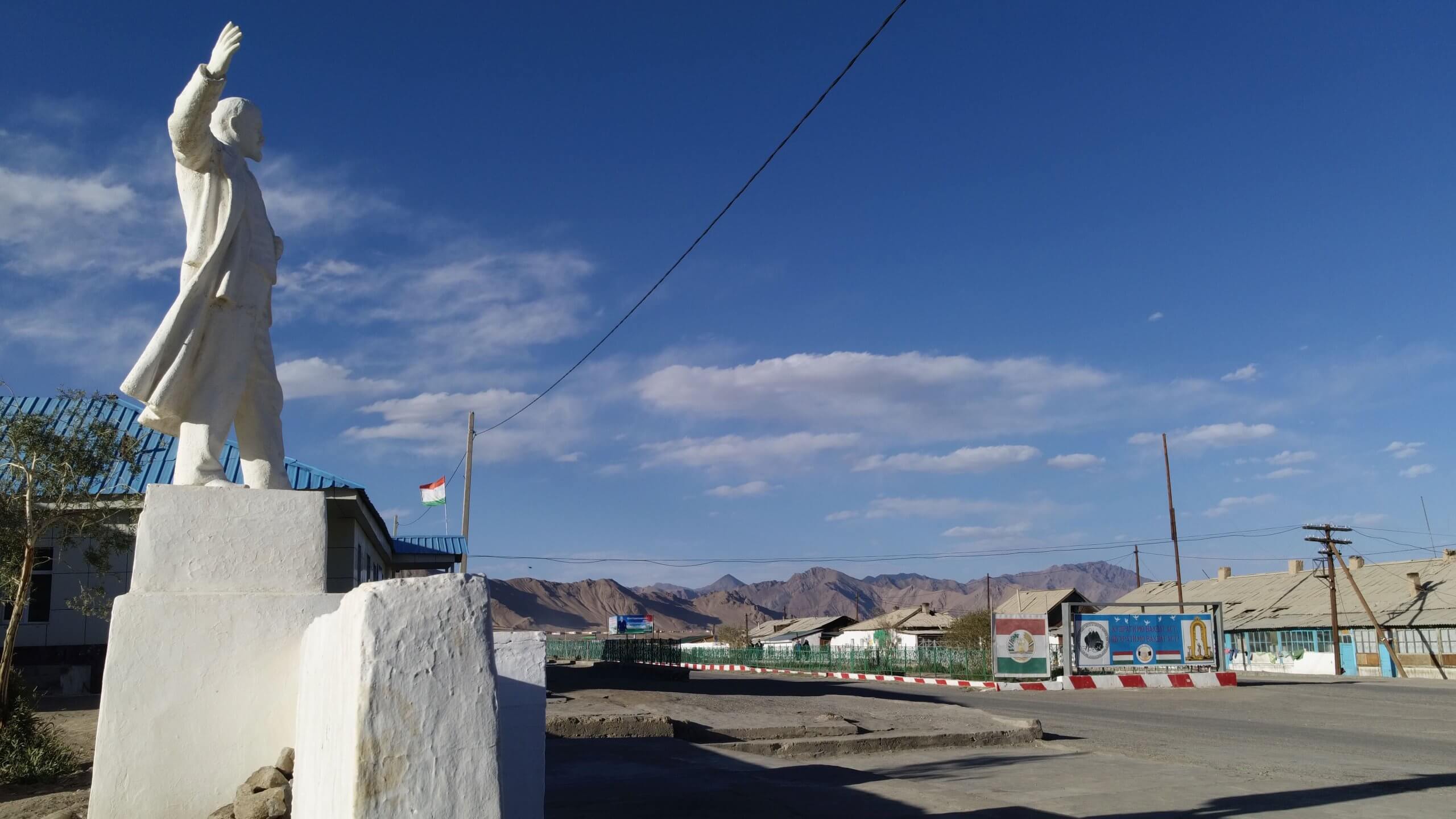
Further on, we discover the mosque not far from a statue of Lenin. Two symbols that sum up Tajikistan's roots.
Lake Karakul: last stop in Tajikistan
Lake Karakul will be our last stop in Tajikistan.
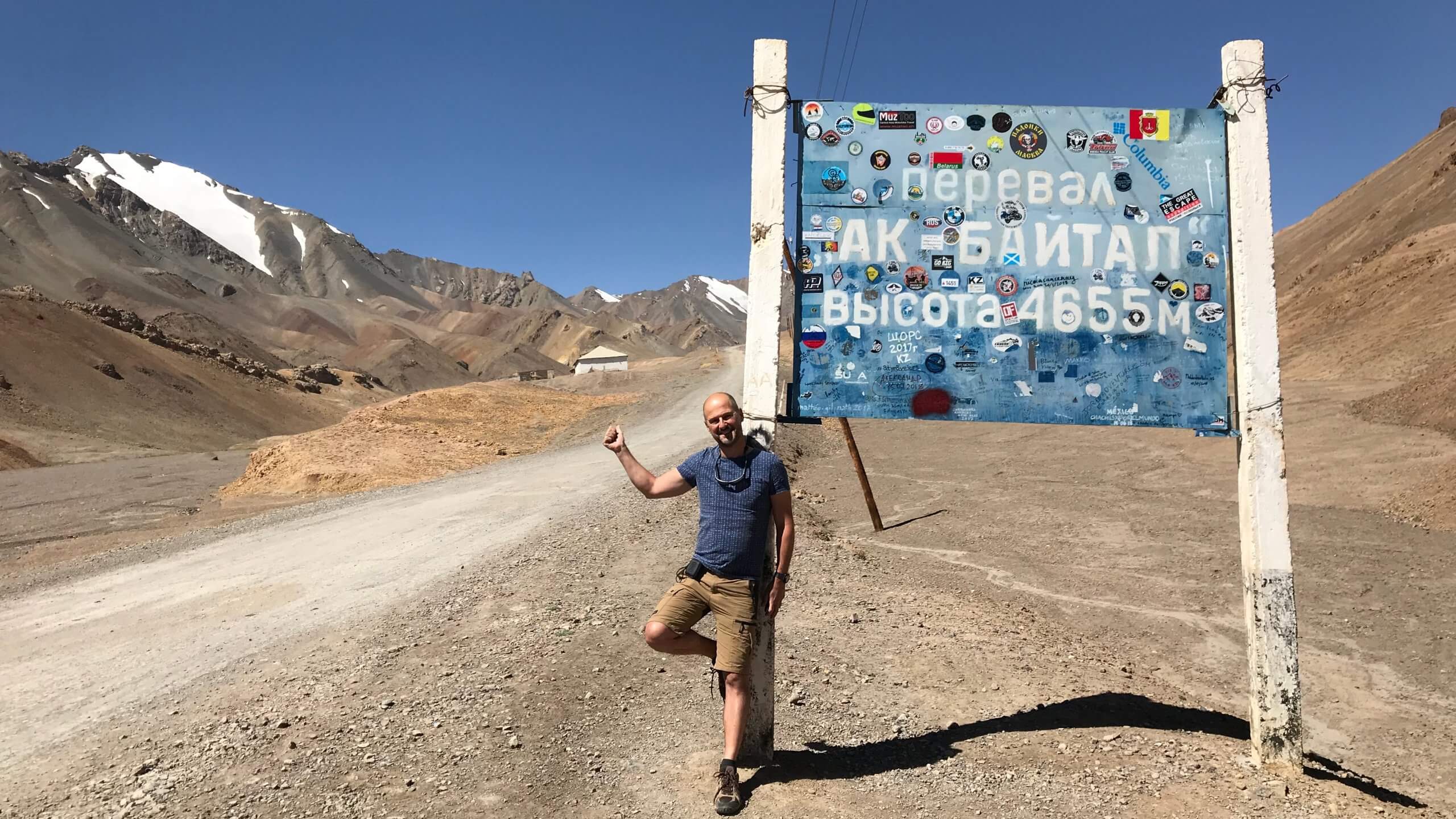
Akbaytal pass
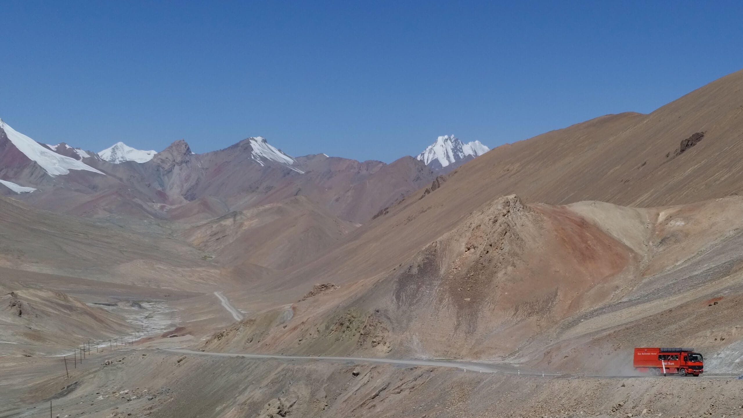
To get there from Murghab, we have to cross the Akbaytal pass at 4655m.
We forget that we're almost at the same altitude as Mont-Blanc, and that climbing that high by car is quite extraordinary!
We have a surprising encounter with a bus full of German pensioners. Rotel is an agency offering a unique concept: a 4x4 bus with twenty mini-cabins and a kitchen.
Still on the Akbaytal pass, we meet up with young Austrian cyclists making the Dushanbe/Osh trip.
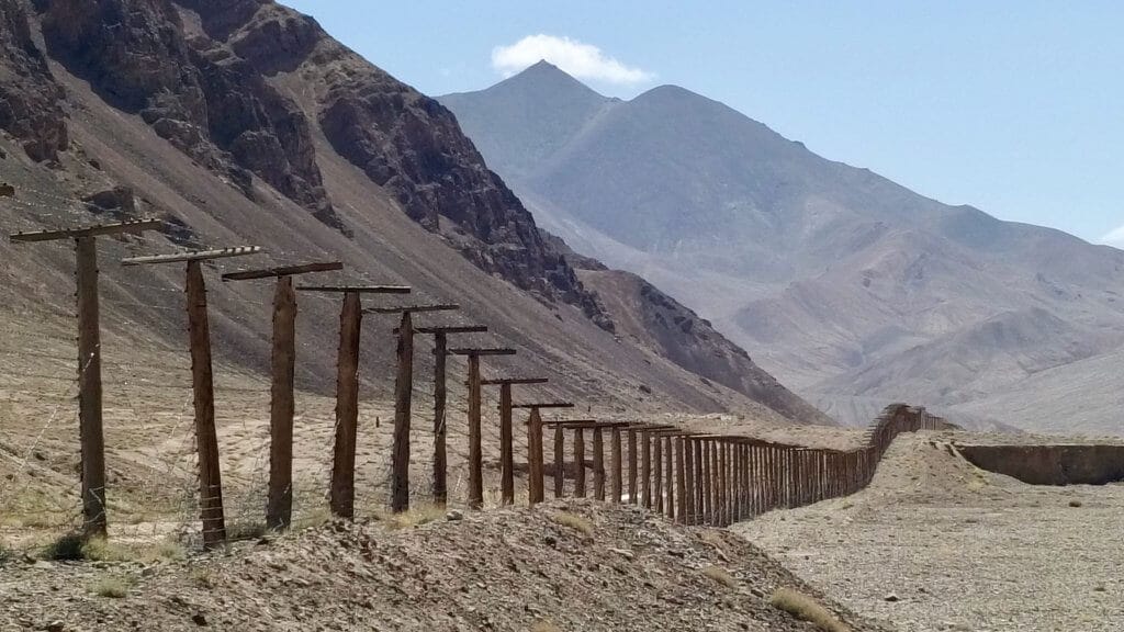
We also skirt the Chinese border, recognizable by its barbed wire that excites our imagination. What's on the other side?
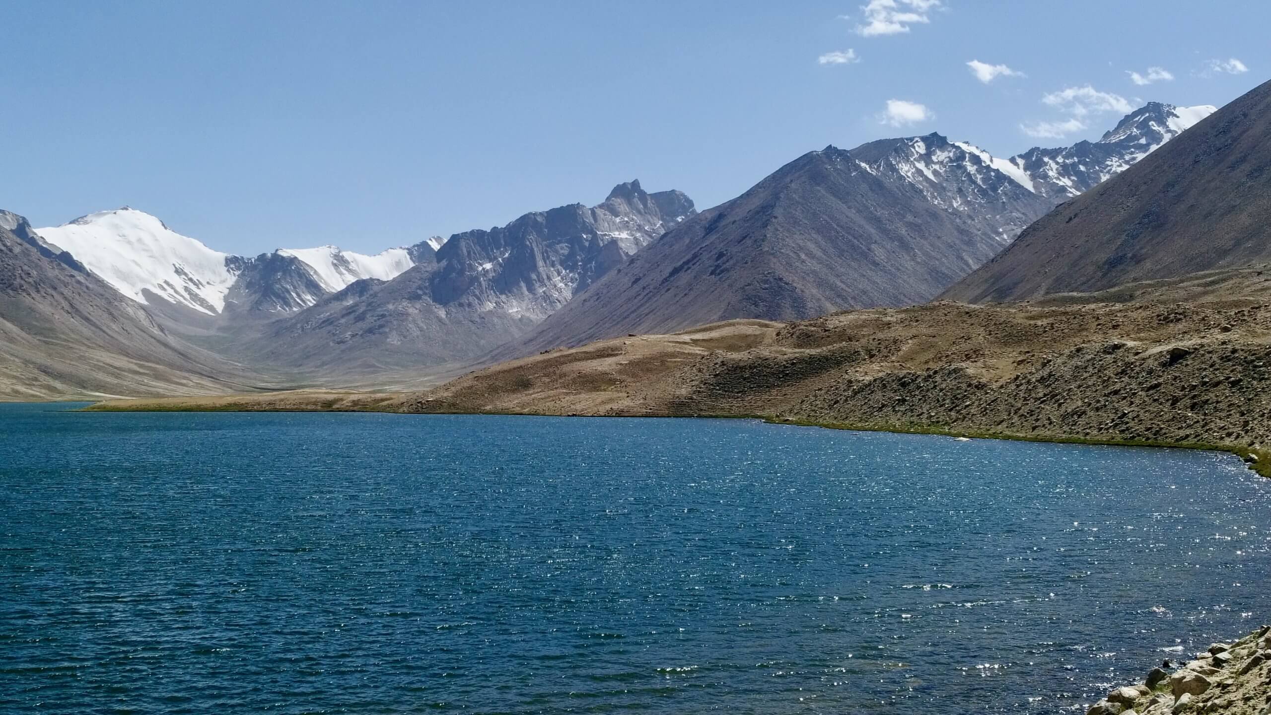
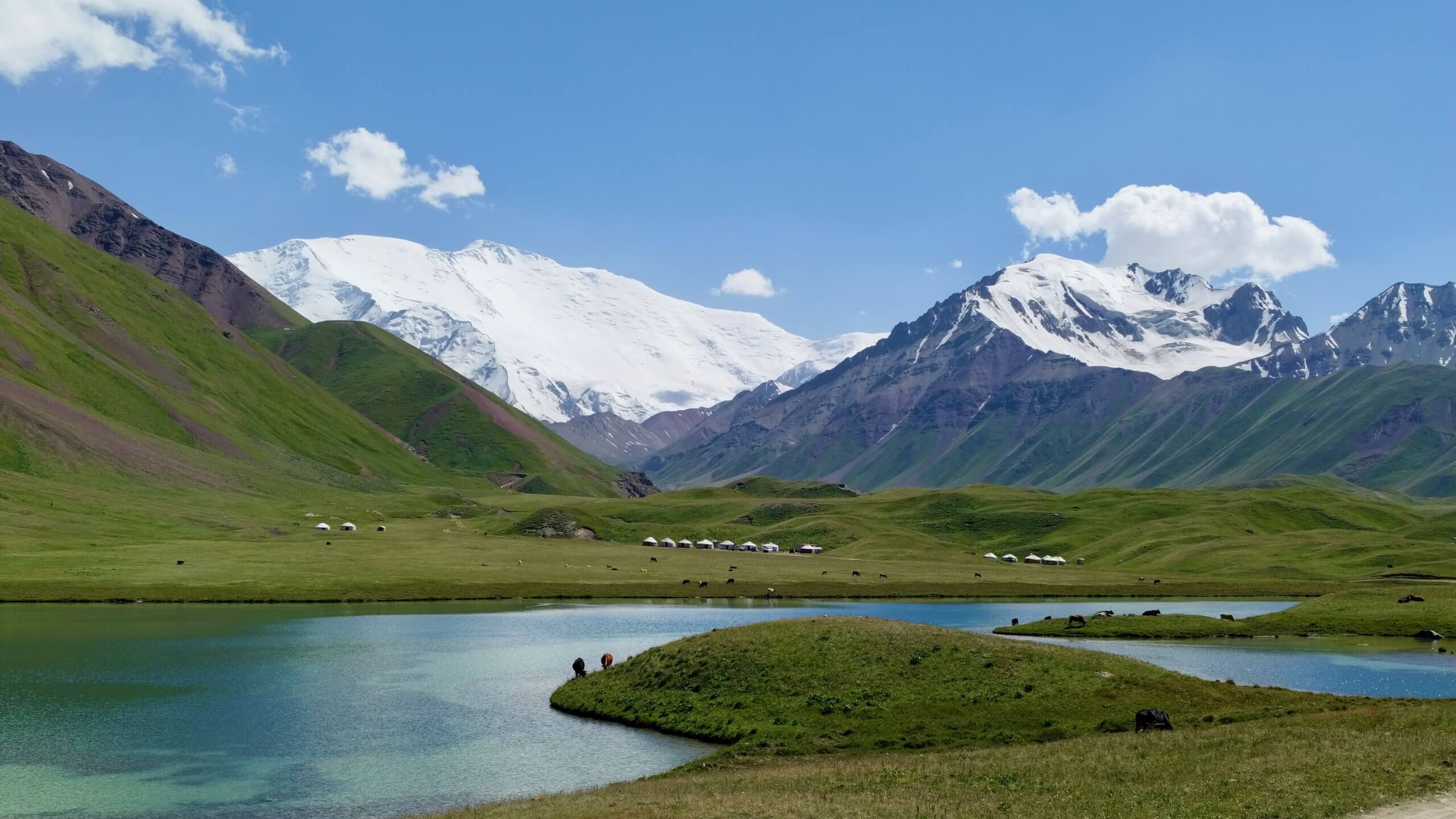
Karakul Lake and its intense blue
Finally, we discover the intensely blue Karakul Lake. Its particularity is that it is salty. It may have been formed by a meteorite five million years ago, but nothing is less certain. Arte produced a nice report that I invite you to watch.
Around the lake, new snow-capped mountains reveal themselves to us to the north towards Kyrgyzstan and to the east towards China.
We don't know where to turn! We walk leisurely through surreal landscapes where the Sahara seems to rub shoulders with high Alpine peaks.


The village of Karakul
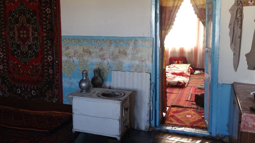
In the village of Karakul, we dine and sleep with the locals.
As on all our trips, the cuisine is simple but hearty. We are offered either :
- plov (carrot rice with meat),
- laghman (noodle soup with vegetables or meat) or
- dimlama (vegetable and potato stew).
- Pilminis (Russian meat-filled ravioli) are sometimes served and
- and always a cucumber and tomato salad.
We sleep on carpets and cushions in a cheerful mess!
Tajikistan/Kyrgyzstan border
We were a little apprehensive about crossing the border. In our experience, land crossings are often more complicated than airport crossings.
The Tajik border post is more than rudimentary and we pass through it without difficulty before crossing the no-man's-land to the Kyrgyzstan checkpoint.
And then a nasty surprise! The Kyrgyz will keep us for almost two hours. Not because of our papers, which the authorities barely looked at. But the customs officers and policemen took advantage of our driver's technical knowledge to ask him to repair one of their cars and the air-conditioning in the chief's office!
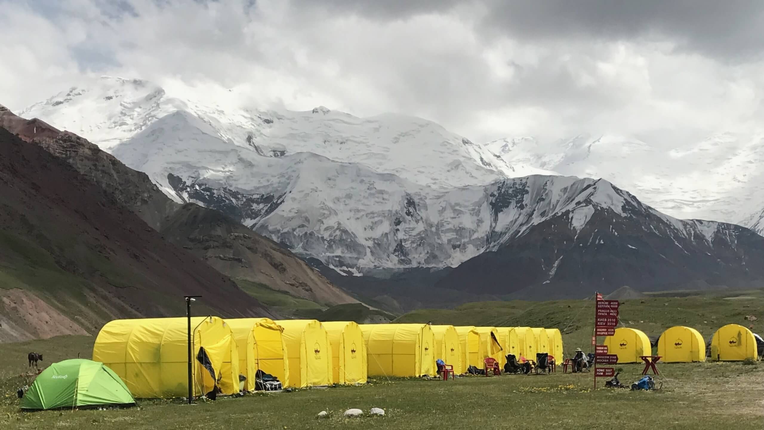
Before discovering Kyrgyzstan, we still have to see a Pamir mountain on the border, and not just any mountain: Peak Lenin!
Lenin Peak: a close-up of the 7000
Peak Lenin, rebaptized Abu Ali Ibn Sina as nobody calls it, stands proudly at a height of 7134 m on the Tajik/Kyrgyz border.
Our expedition was the closest we came to the mountain.
We stay in a small yurt camp for tourists. Tourism is slightly more developed than in Tajikistan, where we only stayed with locals. This would prove true throughout our trip.

The next day, we climb to the foot of the Pic Lenin glaciers.
We pass through the Achik-Tash base camp, where the candidates for the ascent of Peak Lenin meet.
This is a very popular climb, as it is one of the few 7000 that can be climbed without significant technical difficulties. Danger remains, however, and a few climbs have ended in tragedy, such as this women's climb in 1974.
For our part, we' re content to see it from below. And this enormous mass in front of us is already imposing!
We're delighted to note that altitude is no longer a problem for us. Since the start of the trip, we've acclimatized well and are now frolicking with a feeling of lightness at 4500 m altitude!


End of Tajikistan trip
Peak Lenin completes our discovery of the Pamir massif. It's been a real feast for the eyes, and we're lucky that the weather has been exceptional!
From Tulpar Kul we'll be heading back to Osh, Kyrgyzstan's second-largest city, to discover a new mountain range: the Tian San.
That's what I tell you in the third and final part of our expedition here
0 Comments